L44A Lake County Forest Preserve, Grayslake, IL, USA - Earthquake Result Viewer
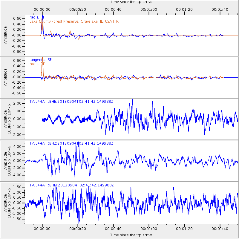
Earthquake location: Andreanof Islands, Aleutian Is.
Earthquake latitude/longitude: 51.6/-174.8
Earthquake time(UTC): 2013/09/04 (247) 02:32:30 GMT
Earthquake Depth: 20 km
Earthquake Magnitude: 6.5 MWW, 5.9 ML, 6.3 MWB, 6.5 MI, 6.5 MWC, 6.5 MWW
Earthquake Catalog/Contributor: NEIC PDE/NEIC COMCAT
Network: TA USArray Transportable Network (new EarthScope stations)
Station: L44A Lake County Forest Preserve, Grayslake, IL, USA
Lat/Lon: 42.18 N/87.91 W
Elevation: 202 m
Distance: 56.8 deg
Az: 62.535 deg
Baz: 311.821 deg
Ray Param: 0.06390266
Estimated Moho Depth: 20.25 km
Estimated Crust Vp/Vs: 1.73
Assumed Crust Vp: 6.483 km/s
Estimated Crust Vs: 3.742 km/s
Estimated Crust Poisson's Ratio: 0.25
Radial Match: 89.54231 %
Radial Bump: 328
Transverse Match: 68.488625 %
Transverse Bump: 400
SOD ConfigId: 626651
Insert Time: 2014-04-18 10:15:49.033 +0000
GWidth: 2.5
Max Bumps: 400
Tol: 0.001

Signal To Noise

ChannelStoNSTALTA
TA:L44A: :BHZ:20130904T02:41:42.149988Z5.62404351.2577239E-62.2363338E-7
TA:L44A: :BHN:20130904T02:41:42.149988Z3.33025386.194898E-71.860188E-7
TA:L44A: :BHE:20130904T02:41:42.149988Z2.01802565.8534323E-72.900574E-7
Arrivals
Ps2.4 SECOND
PpPs8.1 SECOND
PsPs/PpSs11 SECOND