
L48A N Adams, MI, USA - Earthquake Result Viewer
| ||||||||||||||||||
| ||||||||||||||||||
| ||||||||||||||||||
|
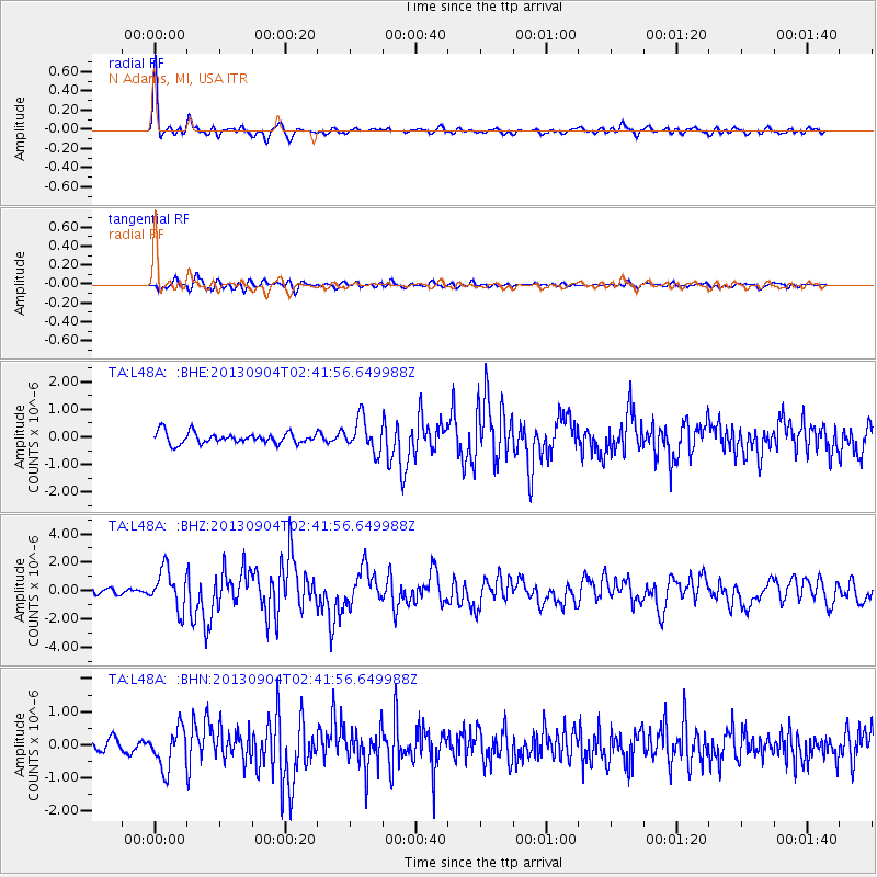
Signal To Noise
| Channel | StoN | STA | LTA |
| TA:L48A: :BHZ:20130904T02:41:56.649988Z | 7.7970963 | 1.3812187E-6 | 1.7714527E-7 |
| TA:L48A: :BHN:20130904T02:41:56.649988Z | 3.4648366 | 5.9404357E-7 | 1.7144924E-7 |
| TA:L48A: :BHE:20130904T02:41:56.649988Z | 2.9850197 | 5.9160345E-7 | 1.9819082E-7 |
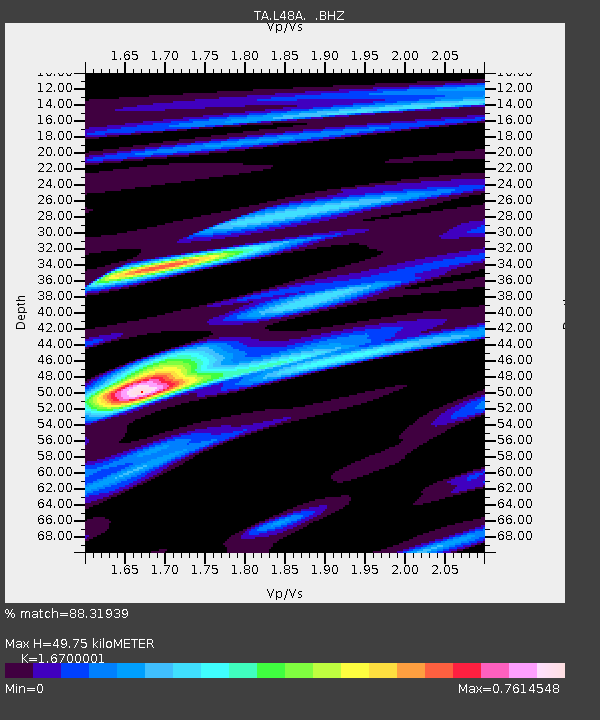
| Arrivals | |
| Ps | 5.4 SECOND |
| PpPs | 19 SECOND |
| PsPs/PpSs | 25 SECOND |

