L49A Milan, MI, USA - Earthquake Result Viewer
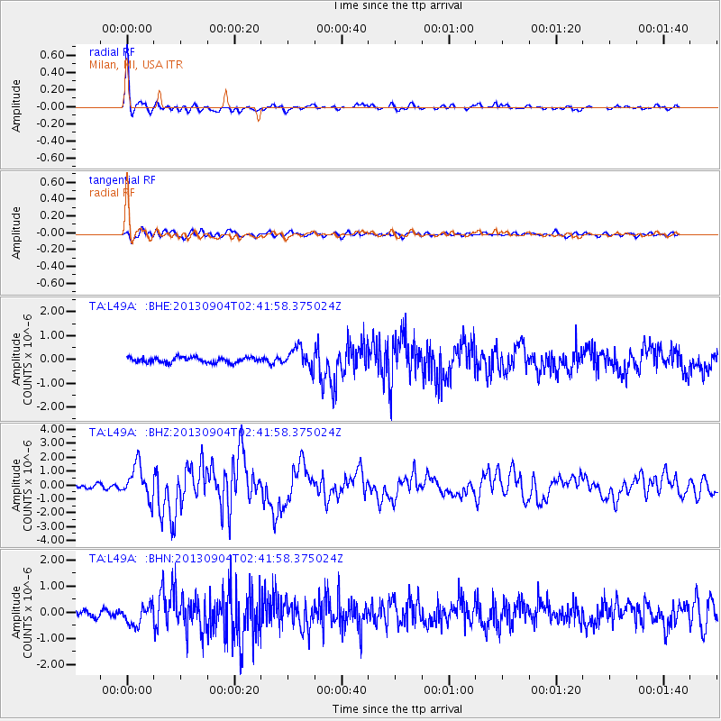
Earthquake location: Andreanof Islands, Aleutian Is.
Earthquake latitude/longitude: 51.6/-174.8
Earthquake time(UTC): 2013/09/04 (247) 02:32:30 GMT
Earthquake Depth: 20 km
Earthquake Magnitude: 6.5 MWW, 5.9 ML, 6.3 MWB, 6.5 MI, 6.5 MWC, 6.5 MWW
Earthquake Catalog/Contributor: NEIC PDE/NEIC COMCAT
Network: TA USArray Transportable Network (new EarthScope stations)
Station: L49A Milan, MI, USA
Lat/Lon: 42.11 N/83.77 W
Elevation: 230 m
Distance: 59.1 deg
Az: 60.135 deg
Baz: 313.317 deg
Ray Param: 0.0623992
Estimated Moho Depth: 23.0 km
Estimated Crust Vp/Vs: 1.69
Assumed Crust Vp: 6.483 km/s
Estimated Crust Vs: 3.847 km/s
Estimated Crust Poisson's Ratio: 0.23
Radial Match: 92.20637 %
Radial Bump: 313
Transverse Match: 74.29978 %
Transverse Bump: 400
SOD ConfigId: 626651
Insert Time: 2014-04-18 10:15:58.962 +0000
GWidth: 2.5
Max Bumps: 400
Tol: 0.001

Signal To Noise

ChannelStoNSTALTA
TA:L49A: :BHZ:20130904T02:41:58.375024Z6.08146861.2278242E-62.01896E-7
TA:L49A: :BHN:20130904T02:41:58.375024Z2.18729763.7518748E-71.7153015E-7
TA:L49A: :BHE:20130904T02:41:58.375024Z3.86586714.3750194E-71.1317045E-7
Arrivals
Ps2.6 SECOND
PpPs9.0 SECOND
PsPs/PpSs12 SECOND