L56A Greenwood, NY, USA - Earthquake Result Viewer
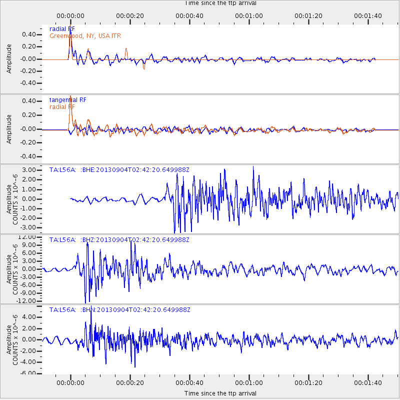
Earthquake location: Andreanof Islands, Aleutian Is.
Earthquake latitude/longitude: 51.6/-174.8
Earthquake time(UTC): 2013/09/04 (247) 02:32:30 GMT
Earthquake Depth: 20 km
Earthquake Magnitude: 6.5 MWW, 5.9 ML, 6.3 MWB, 6.5 MI, 6.5 MWC, 6.5 MWW
Earthquake Catalog/Contributor: NEIC PDE/NEIC COMCAT
Network: TA USArray Transportable Network (new EarthScope stations)
Station: L56A Greenwood, NY, USA
Lat/Lon: 42.14 N/77.56 W
Elevation: 688 m
Distance: 62.4 deg
Az: 56.404 deg
Baz: 315.642 deg
Ray Param: 0.060254924
Estimated Moho Depth: 16.75 km
Estimated Crust Vp/Vs: 1.62
Assumed Crust Vp: 6.476 km/s
Estimated Crust Vs: 3.991 km/s
Estimated Crust Poisson's Ratio: 0.19
Radial Match: 91.206894 %
Radial Bump: 381
Transverse Match: 76.601616 %
Transverse Bump: 400
SOD ConfigId: 626651
Insert Time: 2014-04-18 10:16:12.591 +0000
GWidth: 2.5
Max Bumps: 400
Tol: 0.001

Signal To Noise

ChannelStoNSTALTA
TA:L56A: :BHZ:20130904T02:42:20.649988Z7.017362.3835228E-63.396609E-7
TA:L56A: :BHN:20130904T02:42:20.649988Z2.2617816.652147E-72.9411103E-7
TA:L56A: :BHE:20130904T02:42:20.649988Z3.25515036.708786E-72.0609758E-7
Arrivals
Ps1.7 SECOND
PpPs6.5 SECOND
PsPs/PpSs8.1 SECOND