L57A Andrews Acres Farm, Gillet, PA, USA - Earthquake Result Viewer
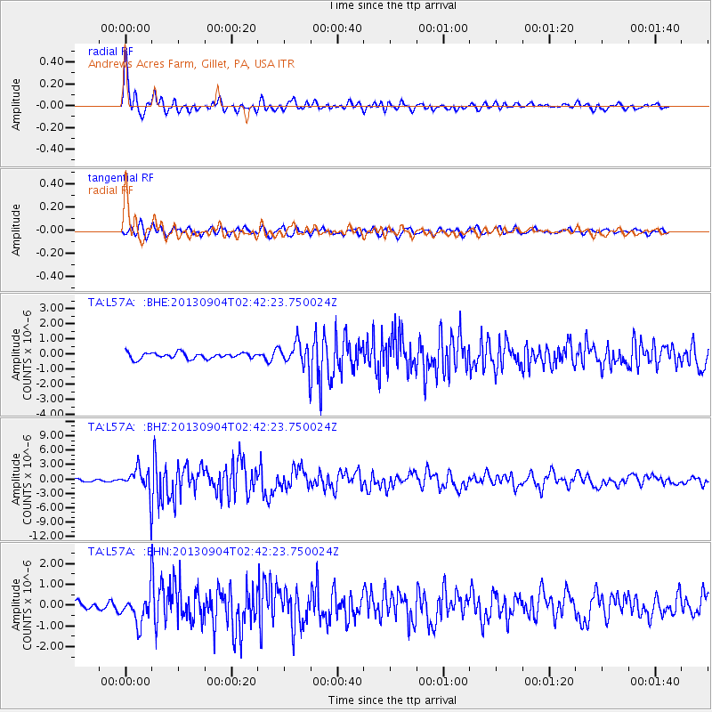
Earthquake location: Andreanof Islands, Aleutian Is.
Earthquake latitude/longitude: 51.6/-174.8
Earthquake time(UTC): 2013/09/04 (247) 02:32:30 GMT
Earthquake Depth: 20 km
Earthquake Magnitude: 6.5 MWW, 5.9 ML, 6.3 MWB, 6.5 MI, 6.5 MWC, 6.5 MWW
Earthquake Catalog/Contributor: NEIC PDE/NEIC COMCAT
Network: TA USArray Transportable Network (new EarthScope stations)
Station: L57A Andrews Acres Farm, Gillet, PA, USA
Lat/Lon: 42.00 N/76.85 W
Elevation: 546 m
Distance: 62.8 deg
Az: 56.084 deg
Baz: 315.969 deg
Ray Param: 0.059951063
Estimated Moho Depth: 43.25 km
Estimated Crust Vp/Vs: 1.80
Assumed Crust Vp: 6.476 km/s
Estimated Crust Vs: 3.608 km/s
Estimated Crust Poisson's Ratio: 0.27
Radial Match: 89.101746 %
Radial Bump: 400
Transverse Match: 82.72549 %
Transverse Bump: 400
SOD ConfigId: 626651
Insert Time: 2014-04-18 10:16:13.072 +0000
GWidth: 2.5
Max Bumps: 400
Tol: 0.001

Signal To Noise

ChannelStoNSTALTA
TA:L57A: :BHZ:20130904T02:42:23.750024Z10.3077442.7857727E-62.7026016E-7
TA:L57A: :BHN:20130904T02:42:23.750024Z4.33175757.422768E-71.7135697E-7
TA:L57A: :BHE:20130904T02:42:23.750024Z4.18617778.1449525E-71.9456778E-7
Arrivals
Ps5.5 SECOND
PpPs18 SECOND
PsPs/PpSs23 SECOND