L59A Walton, NY, USA - Earthquake Result Viewer
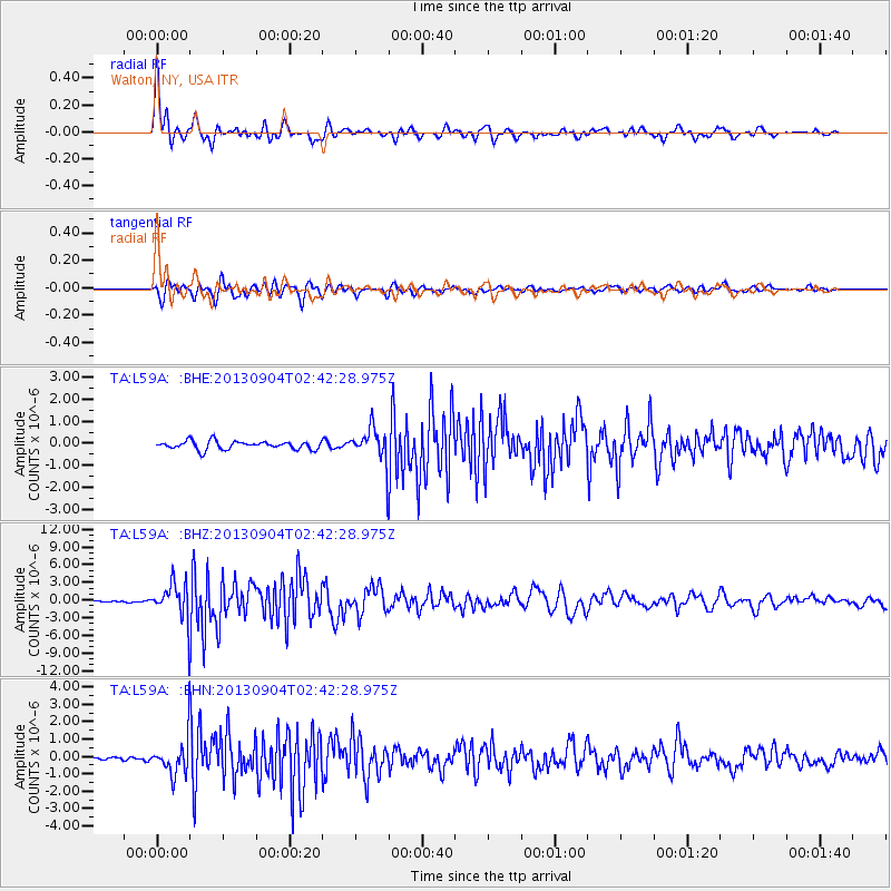
Earthquake location: Andreanof Islands, Aleutian Is.
Earthquake latitude/longitude: 51.6/-174.8
Earthquake time(UTC): 2013/09/04 (247) 02:32:30 GMT
Earthquake Depth: 20 km
Earthquake Magnitude: 6.5 MWW, 5.9 ML, 6.3 MWB, 6.5 MI, 6.5 MWC, 6.5 MWW
Earthquake Catalog/Contributor: NEIC PDE/NEIC COMCAT
Network: TA USArray Transportable Network (new EarthScope stations)
Station: L59A Walton, NY, USA
Lat/Lon: 42.19 N/75.04 W
Elevation: 677 m
Distance: 63.6 deg
Az: 54.848 deg
Baz: 316.619 deg
Ray Param: 0.0594384
Estimated Moho Depth: 15.0 km
Estimated Crust Vp/Vs: 1.60
Assumed Crust Vp: 6.419 km/s
Estimated Crust Vs: 4.012 km/s
Estimated Crust Poisson's Ratio: 0.18
Radial Match: 93.76828 %
Radial Bump: 400
Transverse Match: 83.1312 %
Transverse Bump: 400
SOD ConfigId: 626651
Insert Time: 2014-04-18 10:16:17.570 +0000
GWidth: 2.5
Max Bumps: 400
Tol: 0.001

Signal To Noise

ChannelStoNSTALTA
TA:L59A: :BHZ:20130904T02:42:28.975Z9.5981333.106468E-63.2365335E-7
TA:L59A: :BHN:20130904T02:42:28.975Z5.3194091.000546E-61.8809347E-7
TA:L59A: :BHE:20130904T02:42:28.975Z4.26038277.974609E-71.871806E-7
Arrivals
Ps1.5 SECOND
PpPs5.8 SECOND
PsPs/PpSs7.3 SECOND