M53A WI Miller and Sons, Farmdale, OH, USA - Earthquake Result Viewer
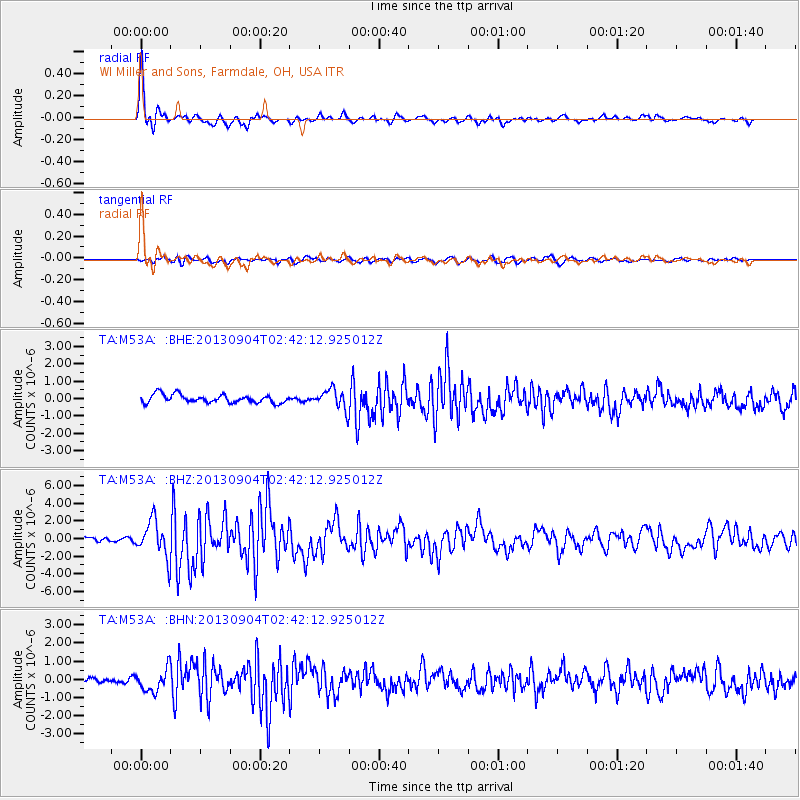
Earthquake location: Andreanof Islands, Aleutian Is.
Earthquake latitude/longitude: 51.6/-174.8
Earthquake time(UTC): 2013/09/04 (247) 02:32:30 GMT
Earthquake Depth: 20 km
Earthquake Magnitude: 6.5 MWW, 5.9 ML, 6.3 MWB, 6.5 MI, 6.5 MWC, 6.5 MWW
Earthquake Catalog/Contributor: NEIC PDE/NEIC COMCAT
Network: TA USArray Transportable Network (new EarthScope stations)
Station: M53A WI Miller and Sons, Farmdale, OH, USA
Lat/Lon: 41.44 N/80.68 W
Elevation: 334 m
Distance: 61.2 deg
Az: 58.837 deg
Baz: 314.723 deg
Ray Param: 0.060997803
Estimated Moho Depth: 22.25 km
Estimated Crust Vp/Vs: 1.84
Assumed Crust Vp: 6.483 km/s
Estimated Crust Vs: 3.533 km/s
Estimated Crust Poisson's Ratio: 0.29
Radial Match: 92.063614 %
Radial Bump: 344
Transverse Match: 66.74718 %
Transverse Bump: 400
SOD ConfigId: 626651
Insert Time: 2014-04-18 10:16:42.447 +0000
GWidth: 2.5
Max Bumps: 400
Tol: 0.001

Signal To Noise

ChannelStoNSTALTA
TA:M53A: :BHZ:20130904T02:42:12.925012Z9.628092.0440775E-62.1230353E-7
TA:M53A: :BHN:20130904T02:42:12.925012Z4.04142246.0681134E-71.5014797E-7
TA:M53A: :BHE:20130904T02:42:12.925012Z2.37045035.696677E-72.4032045E-7
Arrivals
Ps3.0 SECOND
PpPs9.3 SECOND
PsPs/PpSs12 SECOND