N50A Nevada, OH, USA - Earthquake Result Viewer
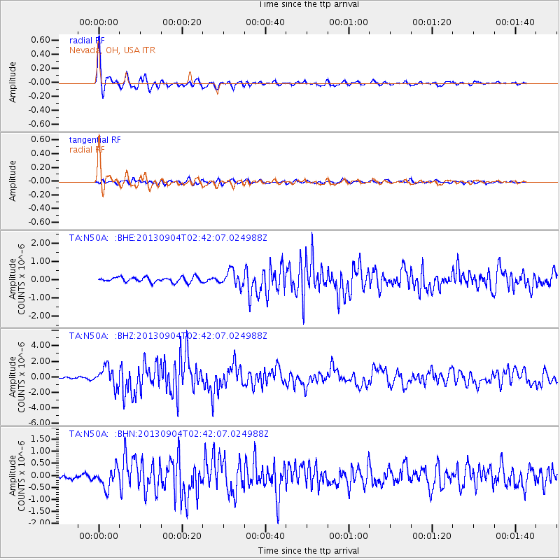
Earthquake location: Andreanof Islands, Aleutian Is.
Earthquake latitude/longitude: 51.6/-174.8
Earthquake time(UTC): 2013/09/04 (247) 02:32:30 GMT
Earthquake Depth: 20 km
Earthquake Magnitude: 6.5 MWW, 5.9 ML, 6.3 MWB, 6.5 MI, 6.5 MWC, 6.5 MWW
Earthquake Catalog/Contributor: NEIC PDE/NEIC COMCAT
Network: TA USArray Transportable Network (new EarthScope stations)
Station: N50A Nevada, OH, USA
Lat/Lon: 40.77 N/83.15 W
Elevation: 277 m
Distance: 60.3 deg
Az: 60.882 deg
Baz: 314.102 deg
Ray Param: 0.061571658
Estimated Moho Depth: 15.5 km
Estimated Crust Vp/Vs: 1.97
Assumed Crust Vp: 6.498 km/s
Estimated Crust Vs: 3.298 km/s
Estimated Crust Poisson's Ratio: 0.33
Radial Match: 92.935555 %
Radial Bump: 350
Transverse Match: 74.139145 %
Transverse Bump: 400
SOD ConfigId: 626651
Insert Time: 2014-04-18 10:17:25.128 +0000
GWidth: 2.5
Max Bumps: 400
Tol: 0.001

Signal To Noise

ChannelStoNSTALTA
TA:N50A: :BHZ:20130904T02:42:07.024988Z10.7561541.3093539E-61.2173068E-7
TA:N50A: :BHN:20130904T02:42:07.024988Z3.10154564.1517882E-71.3386192E-7
TA:N50A: :BHE:20130904T02:42:07.024988Z3.0688964.2024604E-71.369372E-7
Arrivals
Ps2.4 SECOND
PpPs6.8 SECOND
PsPs/PpSs9.2 SECOND