
O03E Paynes Creek, CA, USA - Earthquake Result Viewer
| ||||||||||||||||||
| ||||||||||||||||||
| ||||||||||||||||||
|
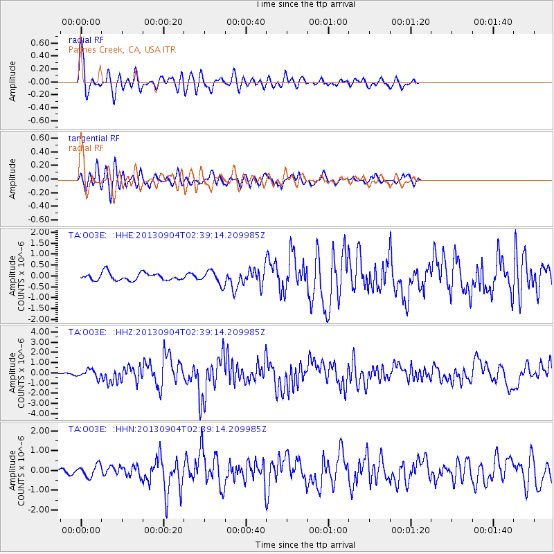
Signal To Noise
| Channel | StoN | STA | LTA |
| TA:O03E: :HHZ:20130904T02:39:14.209985Z | 2.7750468 | 3.9661793E-7 | 1.4292297E-7 |
| TA:O03E: :HHN:20130904T02:39:14.209985Z | 2.0377748 | 3.028917E-7 | 1.4863845E-7 |
| TA:O03E: :HHE:20130904T02:39:14.209985Z | 1.8190445 | 3.1268607E-7 | 1.7189578E-7 |
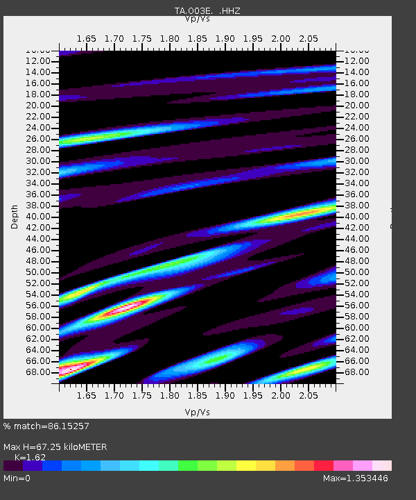
| Arrivals | |
| Ps | 6.9 SECOND |
| PpPs | 25 SECOND |
| PsPs/PpSs | 32 SECOND |

