O48A Farmland, IN, USA - Earthquake Result Viewer
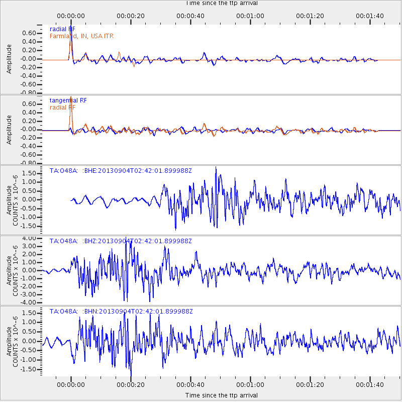
Earthquake location: Andreanof Islands, Aleutian Is.
Earthquake latitude/longitude: 51.6/-174.8
Earthquake time(UTC): 2013/09/04 (247) 02:32:30 GMT
Earthquake Depth: 20 km
Earthquake Magnitude: 6.5 MWW, 5.9 ML, 6.3 MWB, 6.5 MI, 6.5 MWC, 6.5 MWW
Earthquake Catalog/Contributor: NEIC PDE/NEIC COMCAT
Network: TA USArray Transportable Network (new EarthScope stations)
Station: O48A Farmland, IN, USA
Lat/Lon: 40.26 N/85.16 W
Elevation: 300 m
Distance: 59.6 deg
Az: 62.534 deg
Baz: 313.63 deg
Ray Param: 0.062060382
Estimated Moho Depth: 45.0 km
Estimated Crust Vp/Vs: 1.66
Assumed Crust Vp: 6.498 km/s
Estimated Crust Vs: 3.914 km/s
Estimated Crust Poisson's Ratio: 0.22
Radial Match: 89.000885 %
Radial Bump: 395
Transverse Match: 66.04983 %
Transverse Bump: 400
SOD ConfigId: 626651
Insert Time: 2014-04-18 10:17:58.060 +0000
GWidth: 2.5
Max Bumps: 400
Tol: 0.001

Signal To Noise

ChannelStoNSTALTA
TA:O48A: :BHZ:20130904T02:42:01.899988Z6.0412051.1551964E-61.9121953E-7
TA:O48A: :BHN:20130904T02:42:01.899988Z4.4345476.186118E-71.3949831E-7
TA:O48A: :BHE:20130904T02:42:01.899988Z3.4594544.9059145E-71.4181181E-7
Arrivals
Ps4.8 SECOND
PpPs17 SECOND
PsPs/PpSs22 SECOND