O50A Cable, OH, USA - Earthquake Result Viewer
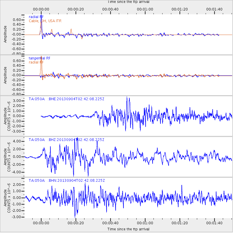
Earthquake location: Andreanof Islands, Aleutian Is.
Earthquake latitude/longitude: 51.6/-174.8
Earthquake time(UTC): 2013/09/04 (247) 02:32:30 GMT
Earthquake Depth: 20 km
Earthquake Magnitude: 6.5 MWW, 5.9 ML, 6.3 MWB, 6.5 MI, 6.5 MWC, 6.5 MWW
Earthquake Catalog/Contributor: NEIC PDE/NEIC COMCAT
Network: TA USArray Transportable Network (new EarthScope stations)
Station: O50A Cable, OH, USA
Lat/Lon: 40.15 N/83.62 W
Elevation: 399 m
Distance: 60.5 deg
Az: 61.684 deg
Baz: 314.193 deg
Ray Param: 0.06145512
Estimated Moho Depth: 32.5 km
Estimated Crust Vp/Vs: 2.10
Assumed Crust Vp: 6.498 km/s
Estimated Crust Vs: 3.098 km/s
Estimated Crust Poisson's Ratio: 0.35
Radial Match: 94.32905 %
Radial Bump: 400
Transverse Match: 78.958145 %
Transverse Bump: 400
SOD ConfigId: 626651
Insert Time: 2014-04-18 10:18:02.431 +0000
GWidth: 2.5
Max Bumps: 400
Tol: 0.001

Signal To Noise

ChannelStoNSTALTA
TA:O50A: :BHZ:20130904T02:42:08.225Z10.4355381.3035193E-61.2491155E-7
TA:O50A: :BHN:20130904T02:42:08.225Z2.63630274.7139181E-71.7880792E-7
TA:O50A: :BHE:20130904T02:42:08.225Z4.22416546.115314E-71.4476976E-7
Arrivals
Ps5.7 SECOND
PpPs15 SECOND
PsPs/PpSs21 SECOND