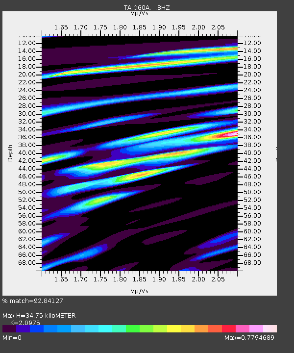
O60A Telford, PA, USA - Earthquake Result Viewer

Earthquake location: Andreanof Islands, Aleutian Is.
Earthquake latitude/longitude: 51.6/-174.8
Earthquake time(UTC): 2013/09/04 (247) 02:32:30 GMT
Earthquake Depth: 20 km
Earthquake Magnitude: 6.5 MWW, 5.9 ML, 6.3 MWB, 6.5 MI, 6.5 MWC, 6.5 MWW
Earthquake Catalog/Contributor: NEIC PDE/NEIC COMCAT
Network: TA USArray Transportable Network (new EarthScope stations)
Station: O60A Telford, PA, USA
Lat/Lon: 40.32 N/75.40 W
Elevation: 70 m
Distance: 64.8 deg
Az: 56.491 deg
Baz: 317.095 deg
Ray Param: 0.05867113
Estimated Moho Depth: 34.75 km
Estimated Crust Vp/Vs: 2.10
Assumed Crust Vp: 6.283 km/s
Estimated Crust Vs: 2.996 km/s
Estimated Crust Poisson's Ratio: 0.35
Radial Match: 92.84127 %
Radial Bump: 400
Transverse Match: 75.174324 %
Transverse Bump: 400
SOD ConfigId: 626651
Insert Time: 2014-04-18 10:18:25.313 +0000
GWidth: 2.5
Max Bumps: 400
Tol: 0.001

Signal To Noise

ChannelStoNSTALTA
TA:O60A: :BHZ:20130904T02:42:36.699976Z9.5954061.8677282E-61.9464818E-7
TA:O60A: :BHN:20130904T02:42:36.699976Z4.78157576.140227E-71.284143E-7
TA:O60A: :BHE:20130904T02:42:36.699976Z1.86920994.2949122E-72.2977154E-7
Arrivals
Ps6.3 SECOND
PpPs17 SECOND
PsPs/PpSs23 SECOND