P55A Reedsville, WV, USA - Earthquake Result Viewer
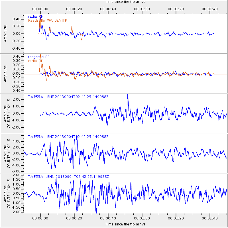
Earthquake location: Andreanof Islands, Aleutian Is.
Earthquake latitude/longitude: 51.6/-174.8
Earthquake time(UTC): 2013/09/04 (247) 02:32:30 GMT
Earthquake Depth: 20 km
Earthquake Magnitude: 6.5 MWW, 5.9 ML, 6.3 MWB, 6.5 MI, 6.5 MWC, 6.5 MWW
Earthquake Catalog/Contributor: NEIC PDE/NEIC COMCAT
Network: TA USArray Transportable Network (new EarthScope stations)
Station: P55A Reedsville, WV, USA
Lat/Lon: 39.51 N/79.83 W
Elevation: 551 m
Distance: 63.0 deg
Az: 59.854 deg
Baz: 315.748 deg
Ray Param: 0.05981427
Estimated Moho Depth: 15.5 km
Estimated Crust Vp/Vs: 2.06
Assumed Crust Vp: 6.159 km/s
Estimated Crust Vs: 2.986 km/s
Estimated Crust Poisson's Ratio: 0.35
Radial Match: 92.04768 %
Radial Bump: 400
Transverse Match: 76.9702 %
Transverse Bump: 400
SOD ConfigId: 626651
Insert Time: 2014-04-18 10:18:50.697 +0000
GWidth: 2.5
Max Bumps: 400
Tol: 0.001

Signal To Noise

ChannelStoNSTALTA
TA:P55A: :BHZ:20130904T02:42:25.149988Z6.26619151.7544545E-62.7998738E-7
TA:P55A: :BHN:20130904T02:42:25.149988Z3.24420743.969191E-71.2234702E-7
TA:P55A: :BHE:20130904T02:42:25.149988Z2.86349464.6351786E-71.618714E-7
Arrivals
Ps2.8 SECOND
PpPs7.4 SECOND
PsPs/PpSs10 SECOND