
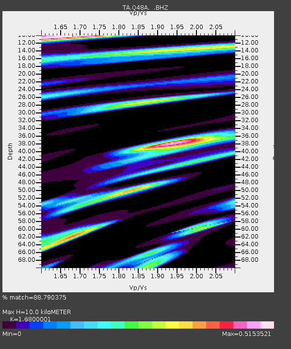
Q48A North Vernon, IN, USA - Earthquake Result Viewer
| ||||||||||||||||||
| ||||||||||||||||||
| ||||||||||||||||||
|
Signal To Noise
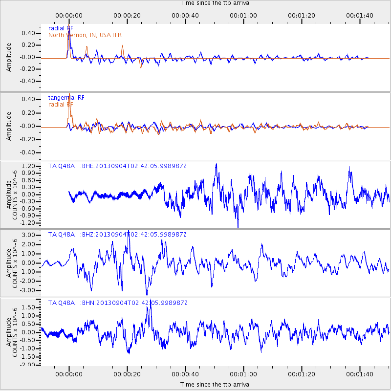
| Channel | StoN | STA | LTA |
| TA:Q48A: :BHZ:20130904T02:42:05.998987Z | 6.164567 | 9.679359E-7 | 1.5701603E-7 |
| TA:Q48A: :BHN:20130904T02:42:05.998987Z | 2.2583482 | 2.7579404E-7 | 1.2212202E-7 |
| TA:Q48A: :BHE:20130904T02:42:05.998987Z | 3.0337186 | 3.2471422E-7 | 1.07035056E-7 |
| Arrivals | |
| Ps | 1.1 SECOND |
| PpPs | 3.9 SECOND |
| PsPs/PpSs | 5.0 SECOND |

