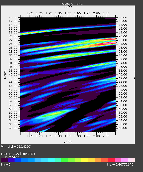
Q51A Peebles, OH, USA - Earthquake Result Viewer
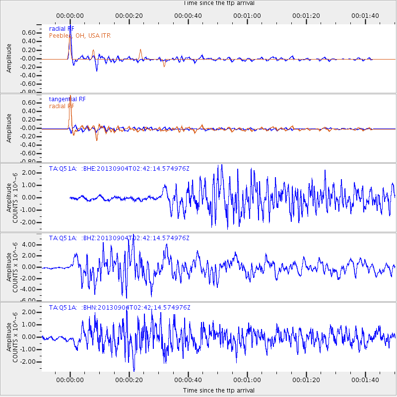
Earthquake location: Andreanof Islands, Aleutian Is.
Earthquake latitude/longitude: 51.6/-174.8
Earthquake time(UTC): 2013/09/04 (247) 02:32:30 GMT
Earthquake Depth: 20 km
Earthquake Magnitude: 6.5 MWW, 5.9 ML, 6.3 MWB, 6.5 MI, 6.5 MWC, 6.5 MWW
Earthquake Catalog/Contributor: NEIC PDE/NEIC COMCAT
Network: TA USArray Transportable Network (new EarthScope stations)
Station: Q51A Peebles, OH, USA
Lat/Lon: 39.03 N/83.35 W
Elevation: 362 m
Distance: 61.5 deg
Az: 62.428 deg
Baz: 314.728 deg
Ray Param: 0.06084021
Estimated Moho Depth: 21.0 km
Estimated Crust Vp/Vs: 2.10
Assumed Crust Vp: 6.232 km/s
Estimated Crust Vs: 2.971 km/s
Estimated Crust Poisson's Ratio: 0.35
Radial Match: 96.18157 %
Radial Bump: 400
Transverse Match: 84.53392 %
Transverse Bump: 400
SOD ConfigId: 626651
Insert Time: 2014-04-18 10:19:16.890 +0000
GWidth: 2.5
Max Bumps: 400
Tol: 0.001

Signal To Noise

ChannelStoNSTALTA
TA:Q51A: :BHZ:20130904T02:42:14.574976Z14.0151541.5089687E-61.0766694E-7
TA:Q51A: :BHN:20130904T02:42:14.574976Z4.66537955.602222E-71.2008073E-7
TA:Q51A: :BHE:20130904T02:42:14.574976Z5.642156.35722E-71.12673725E-7
Arrivals
Ps3.8 SECOND
PpPs10 SECOND
PsPs/PpSs14 SECOND