
Q53A Leroy, WV, USA - Earthquake Result Viewer
| ||||||||||||||||||
| ||||||||||||||||||
| ||||||||||||||||||
|
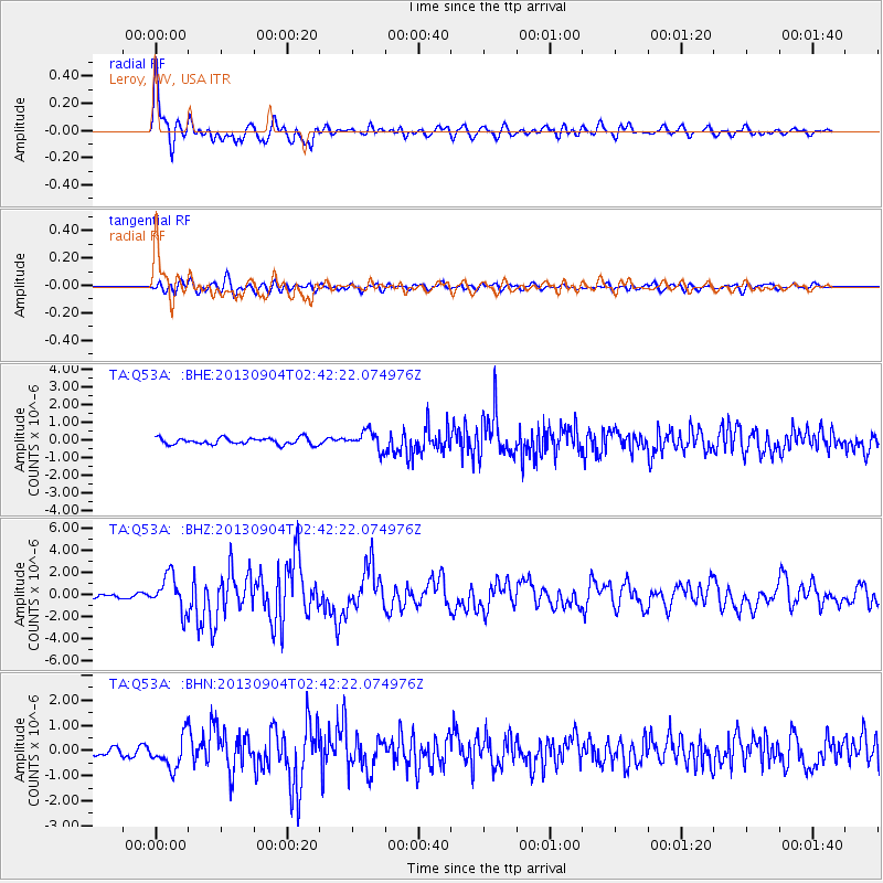
Signal To Noise
| Channel | StoN | STA | LTA |
| TA:Q53A: :BHZ:20130904T02:42:22.074976Z | 9.737141 | 1.5969548E-6 | 1.6400656E-7 |
| TA:Q53A: :BHN:20130904T02:42:22.074976Z | 3.8501904 | 6.256425E-7 | 1.624965E-7 |
| TA:Q53A: :BHE:20130904T02:42:22.074976Z | 2.7843223 | 5.1678575E-7 | 1.8560557E-7 |
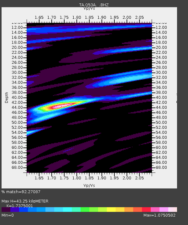
| Arrivals | |
| Ps | 5.4 SECOND |
| PpPs | 18 SECOND |
| PsPs/PpSs | 24 SECOND |

