Q56A Snyder Ridge, Maysville, WV, USA - Earthquake Result Viewer
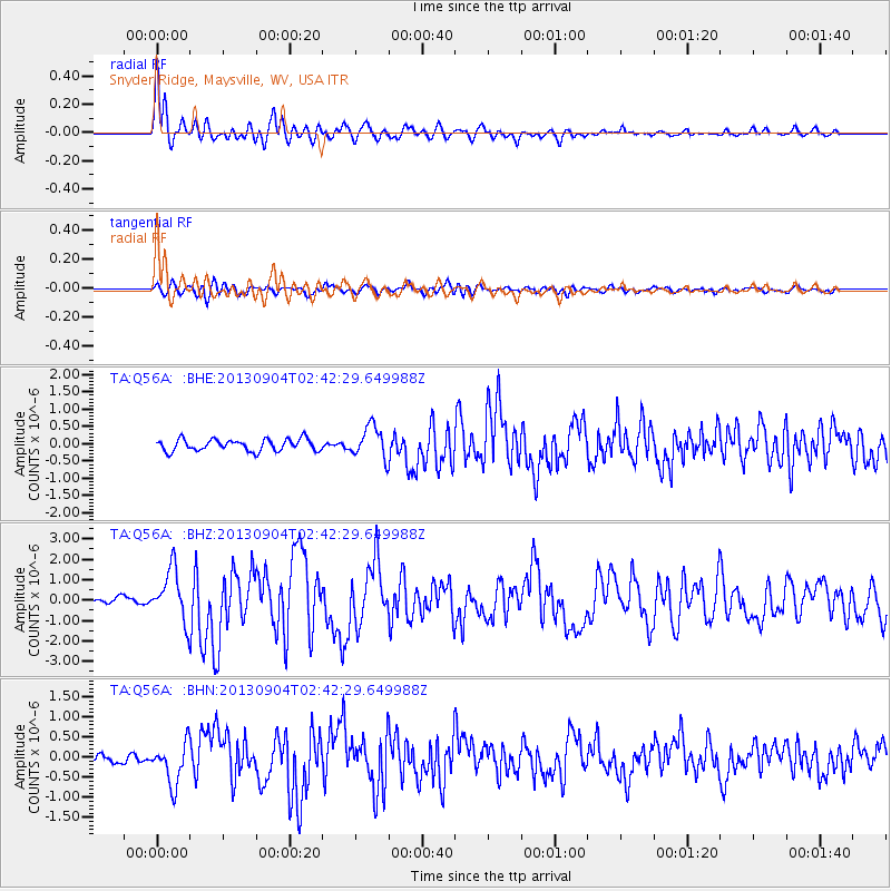
Earthquake location: Andreanof Islands, Aleutian Is.
Earthquake latitude/longitude: 51.6/-174.8
Earthquake time(UTC): 2013/09/04 (247) 02:32:30 GMT
Earthquake Depth: 20 km
Earthquake Magnitude: 6.5 MWW, 5.9 ML, 6.3 MWB, 6.5 MI, 6.5 MWC, 6.5 MWW
Earthquake Catalog/Contributor: NEIC PDE/NEIC COMCAT
Network: TA USArray Transportable Network (new EarthScope stations)
Station: Q56A Snyder Ridge, Maysville, WV, USA
Lat/Lon: 39.04 N/79.19 W
Elevation: 430 m
Distance: 63.7 deg
Az: 59.817 deg
Baz: 316.135 deg
Ray Param: 0.05937322
Estimated Moho Depth: 39.25 km
Estimated Crust Vp/Vs: 1.88
Assumed Crust Vp: 6.159 km/s
Estimated Crust Vs: 3.267 km/s
Estimated Crust Poisson's Ratio: 0.30
Radial Match: 89.656075 %
Radial Bump: 400
Transverse Match: 69.743744 %
Transverse Bump: 400
SOD ConfigId: 626651
Insert Time: 2014-04-18 10:19:27.474 +0000
GWidth: 2.5
Max Bumps: 400
Tol: 0.001

Signal To Noise

ChannelStoNSTALTA
TA:Q56A: :BHZ:20130904T02:42:29.649988Z8.6583281.2587165E-61.4537639E-7
TA:Q56A: :BHN:20130904T02:42:29.649988Z4.7028935.1723043E-71.0998134E-7
TA:Q56A: :BHE:20130904T02:42:29.649988Z2.7108364.5753958E-71.6878174E-7
Arrivals
Ps5.9 SECOND
PpPs18 SECOND
PsPs/PpSs24 SECOND