R50A Paris, KY, USA - Earthquake Result Viewer
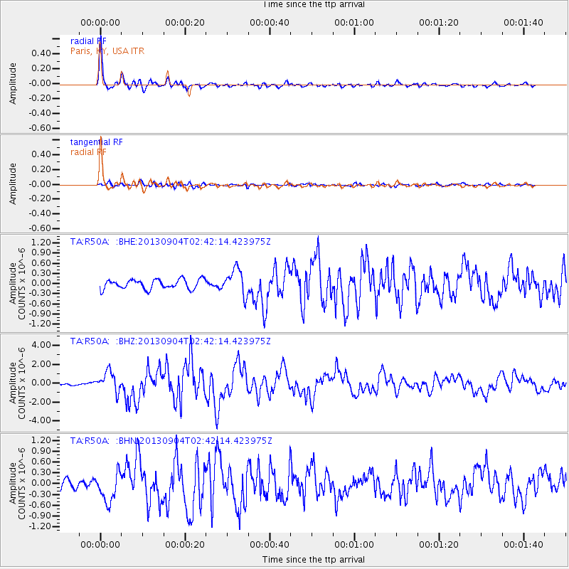
Earthquake location: Andreanof Islands, Aleutian Is.
Earthquake latitude/longitude: 51.6/-174.8
Earthquake time(UTC): 2013/09/04 (247) 02:32:30 GMT
Earthquake Depth: 20 km
Earthquake Magnitude: 6.5 MWW, 5.9 ML, 6.3 MWB, 6.5 MI, 6.5 MWC, 6.5 MWW
Earthquake Catalog/Contributor: NEIC PDE/NEIC COMCAT
Network: TA USArray Transportable Network (new EarthScope stations)
Station: R50A Paris, KY, USA
Lat/Lon: 38.28 N/84.33 W
Elevation: 255 m
Distance: 61.4 deg
Az: 63.645 deg
Baz: 314.699 deg
Ray Param: 0.060855
Estimated Moho Depth: 38.25 km
Estimated Crust Vp/Vs: 1.86
Assumed Crust Vp: 6.498 km/s
Estimated Crust Vs: 3.493 km/s
Estimated Crust Poisson's Ratio: 0.30
Radial Match: 94.46116 %
Radial Bump: 398
Transverse Match: 77.35158 %
Transverse Bump: 400
SOD ConfigId: 626651
Insert Time: 2014-04-18 10:19:46.034 +0000
GWidth: 2.5
Max Bumps: 400
Tol: 0.001

Signal To Noise

ChannelStoNSTALTA
TA:R50A: :BHZ:20130904T02:42:14.423975Z8.50460151.0968848E-61.2897546E-7
TA:R50A: :BHN:20130904T02:42:14.423975Z4.12942174.1132168E-79.960758E-8
TA:R50A: :BHE:20130904T02:42:14.423975Z2.79953863.963383E-71.4157271E-7
Arrivals
Ps5.3 SECOND
PpPs16 SECOND
PsPs/PpSs21 SECOND