
R54A Victor, WV, USA - Earthquake Result Viewer
| ||||||||||||||||||
| ||||||||||||||||||
| ||||||||||||||||||
|
Signal To Noise
| Channel | StoN | STA | LTA |
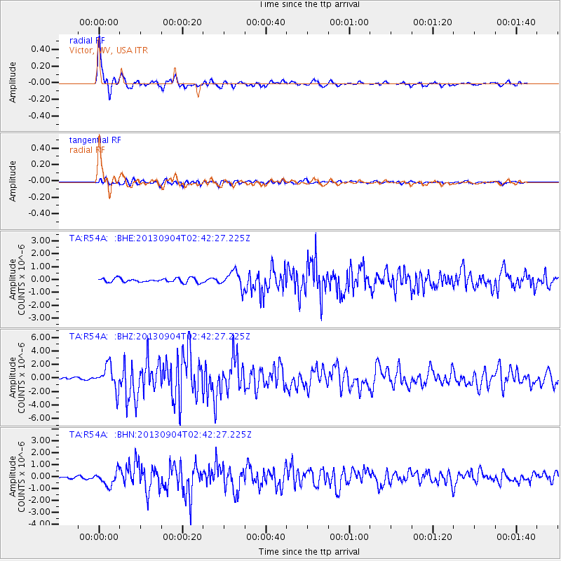
| TA:R54A: :BHZ:20130904T02:42:27.225Z | 12.60947 | 1.8209245E-6 | 1.4440927E-7 |
| TA:R54A: :BHN:20130904T02:42:27.225Z | 5.1018558 | 6.082333E-7 | 1.1921804E-7 |
| TA:R54A: :BHE:20130904T02:42:27.225Z | 4.219154 | 6.47613E-7 | 1.5349357E-7 |
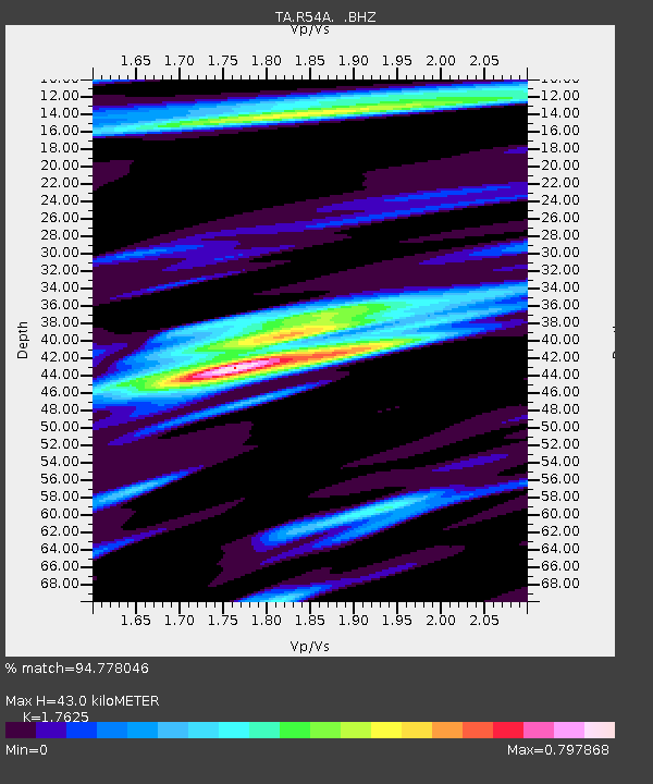
| Arrivals | |
| Ps | 5.5 SECOND |
| PpPs | 18 SECOND |
| PsPs/PpSs | 24 SECOND |

