R58B Mineral, VA, USA - Earthquake Result Viewer
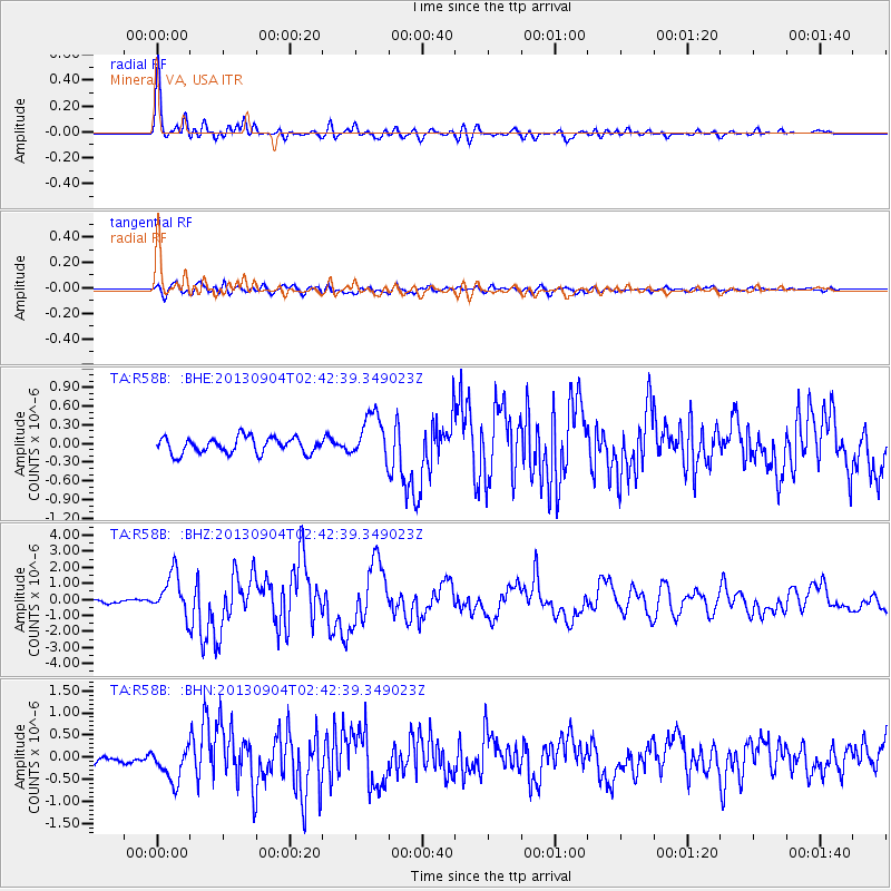
Earthquake location: Andreanof Islands, Aleutian Is.
Earthquake latitude/longitude: 51.6/-174.8
Earthquake time(UTC): 2013/09/04 (247) 02:32:30 GMT
Earthquake Depth: 20 km
Earthquake Magnitude: 6.5 MWW, 5.9 ML, 6.3 MWB, 6.5 MI, 6.5 MWC, 6.5 MWW
Earthquake Catalog/Contributor: NEIC PDE/NEIC COMCAT
Network: TA USArray Transportable Network (new EarthScope stations)
Station: R58B Mineral, VA, USA
Lat/Lon: 37.96 N/77.88 W
Elevation: 116 m
Distance: 65.2 deg
Az: 59.812 deg
Baz: 316.943 deg
Ray Param: 0.05840339
Estimated Moho Depth: 67.75 km
Estimated Crust Vp/Vs: 1.66
Assumed Crust Vp: 6.565 km/s
Estimated Crust Vs: 3.949 km/s
Estimated Crust Poisson's Ratio: 0.22
Radial Match: 94.62781 %
Radial Bump: 400
Transverse Match: 75.94513 %
Transverse Bump: 400
SOD ConfigId: 626651
Insert Time: 2014-04-18 10:20:09.156 +0000
GWidth: 2.5
Max Bumps: 400
Tol: 0.001

Signal To Noise

ChannelStoNSTALTA
TA:R58B: :BHZ:20130904T02:42:39.349023Z13.5536361.2913375E-69.527609E-8
TA:R58B: :BHN:20130904T02:42:39.349023Z4.66706373.882135E-78.3181526E-8
TA:R58B: :BHE:20130904T02:42:39.349023Z2.84951193.6477363E-71.2801267E-7
Arrivals
Ps7.2 SECOND
PpPs26 SECOND
PsPs/PpSs33 SECOND