R59A King George, VA, USA - Earthquake Result Viewer
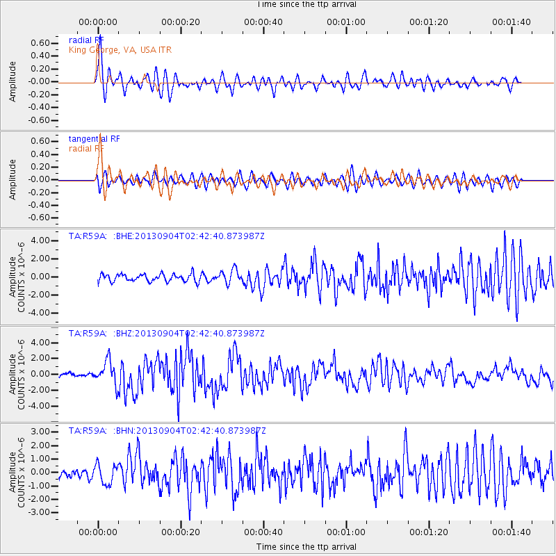
Earthquake location: Andreanof Islands, Aleutian Is.
Earthquake latitude/longitude: 51.6/-174.8
Earthquake time(UTC): 2013/09/04 (247) 02:32:30 GMT
Earthquake Depth: 20 km
Earthquake Magnitude: 6.5 MWW, 5.9 ML, 6.3 MWB, 6.5 MI, 6.5 MWC, 6.5 MWW
Earthquake Catalog/Contributor: NEIC PDE/NEIC COMCAT
Network: TA USArray Transportable Network (new EarthScope stations)
Station: R59A King George, VA, USA
Lat/Lon: 38.20 N/77.12 W
Elevation: 35 m
Distance: 65.4 deg
Az: 59.15 deg
Baz: 317.135 deg
Ray Param: 0.058247644
Estimated Moho Depth: 38.0 km
Estimated Crust Vp/Vs: 1.88
Assumed Crust Vp: 6.419 km/s
Estimated Crust Vs: 3.419 km/s
Estimated Crust Poisson's Ratio: 0.30
Radial Match: 84.16475 %
Radial Bump: 400
Transverse Match: 56.99377 %
Transverse Bump: 400
SOD ConfigId: 626651
Insert Time: 2014-04-18 10:20:09.520 +0000
GWidth: 2.5
Max Bumps: 400
Tol: 0.001

Signal To Noise

ChannelStoNSTALTA
TA:R59A: :BHZ:20130904T02:42:40.873987Z9.3554171.559815E-61.6672854E-7
TA:R59A: :BHN:20130904T02:42:40.873987Z2.66925077.3798697E-72.764772E-7
TA:R59A: :BHE:20130904T02:42:40.873987Z1.8863277.6909316E-74.0771994E-7
Arrivals
Ps5.4 SECOND
PpPs16 SECOND
PsPs/PpSs22 SECOND