S44A Carbondale, IL, USA - Earthquake Result Viewer
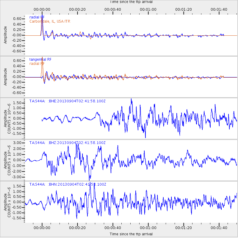
Earthquake location: Andreanof Islands, Aleutian Is.
Earthquake latitude/longitude: 51.6/-174.8
Earthquake time(UTC): 2013/09/04 (247) 02:32:30 GMT
Earthquake Depth: 20 km
Earthquake Magnitude: 6.5 MWW, 5.9 ML, 6.3 MWB, 6.5 MI, 6.5 MWC, 6.5 MWW
Earthquake Catalog/Contributor: NEIC PDE/NEIC COMCAT
Network: TA USArray Transportable Network (new EarthScope stations)
Station: S44A Carbondale, IL, USA
Lat/Lon: 37.69 N/89.26 W
Elevation: 155 m
Distance: 59.0 deg
Az: 67.251 deg
Baz: 313.468 deg
Ray Param: 0.062426504
Estimated Moho Depth: 11.25 km
Estimated Crust Vp/Vs: 2.08
Assumed Crust Vp: 6.444 km/s
Estimated Crust Vs: 3.102 km/s
Estimated Crust Poisson's Ratio: 0.35
Radial Match: 93.45106 %
Radial Bump: 400
Transverse Match: 82.25955 %
Transverse Bump: 400
SOD ConfigId: 626651
Insert Time: 2014-04-18 10:20:18.625 +0000
GWidth: 2.5
Max Bumps: 400
Tol: 0.001

Signal To Noise

ChannelStoNSTALTA
TA:S44A: :BHZ:20130904T02:41:58.100Z7.78363288.417417E-71.0814254E-7
TA:S44A: :BHN:20130904T02:41:58.100Z3.27365923.4656824E-71.0586571E-7
TA:S44A: :BHE:20130904T02:41:58.100Z2.28930973.8803677E-71.6949946E-7
Arrivals
Ps2.0 SECOND
PpPs5.2 SECOND
PsPs/PpSs7.1 SECOND