S49A Springfield, KY, USA - Earthquake Result Viewer
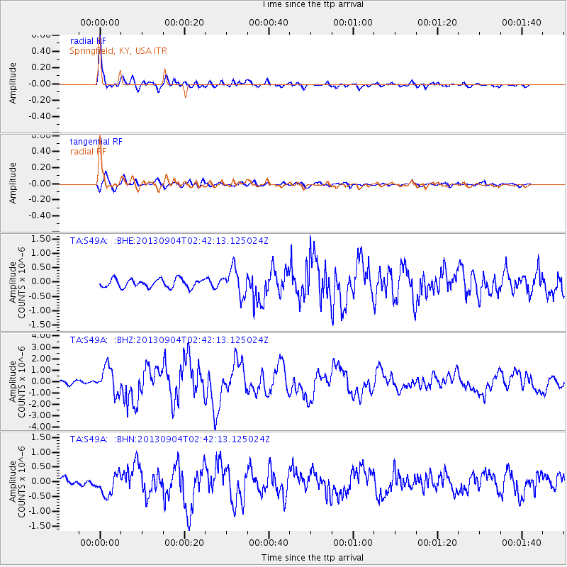
Earthquake location: Andreanof Islands, Aleutian Is.
Earthquake latitude/longitude: 51.6/-174.8
Earthquake time(UTC): 2013/09/04 (247) 02:32:30 GMT
Earthquake Depth: 20 km
Earthquake Magnitude: 6.5 MWW, 5.9 ML, 6.3 MWB, 6.5 MI, 6.5 MWC, 6.5 MWW
Earthquake Catalog/Contributor: NEIC PDE/NEIC COMCAT
Network: TA USArray Transportable Network (new EarthScope stations)
Station: S49A Springfield, KY, USA
Lat/Lon: 37.78 N/85.29 W
Elevation: 230 m
Distance: 61.2 deg
Az: 64.654 deg
Baz: 314.594 deg
Ray Param: 0.06097854
Estimated Moho Depth: 36.25 km
Estimated Crust Vp/Vs: 1.97
Assumed Crust Vp: 6.476 km/s
Estimated Crust Vs: 3.287 km/s
Estimated Crust Poisson's Ratio: 0.33
Radial Match: 89.16673 %
Radial Bump: 400
Transverse Match: 84.82351 %
Transverse Bump: 400
SOD ConfigId: 626651
Insert Time: 2014-04-18 10:20:19.684 +0000
GWidth: 2.5
Max Bumps: 400
Tol: 0.001

Signal To Noise

ChannelStoNSTALTA
TA:S49A: :BHZ:20130904T02:42:13.125024Z6.4263941.1631646E-61.8099803E-7
TA:S49A: :BHN:20130904T02:42:13.125024Z3.22068213.6701786E-71.1395656E-7
TA:S49A: :BHE:20130904T02:42:13.125024Z3.30668044.721839E-71.4279695E-7
Arrivals
Ps5.7 SECOND
PpPs16 SECOND
PsPs/PpSs22 SECOND