S50A Richmond, KY, USA - Earthquake Result Viewer
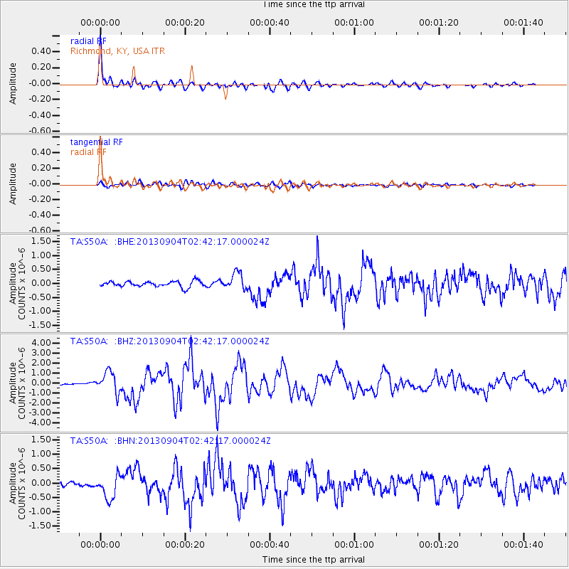
Earthquake location: Andreanof Islands, Aleutian Is.
Earthquake latitude/longitude: 51.6/-174.8
Earthquake time(UTC): 2013/09/04 (247) 02:32:30 GMT
Earthquake Depth: 20 km
Earthquake Magnitude: 6.5 MWW, 5.9 ML, 6.3 MWB, 6.5 MI, 6.5 MWC, 6.5 MWW
Earthquake Catalog/Contributor: NEIC PDE/NEIC COMCAT
Network: TA USArray Transportable Network (new EarthScope stations)
Station: S50A Richmond, KY, USA
Lat/Lon: 37.68 N/84.40 W
Elevation: 300 m
Distance: 61.8 deg
Az: 64.176 deg
Baz: 314.907 deg
Ray Param: 0.060612414
Estimated Moho Depth: 20.25 km
Estimated Crust Vp/Vs: 1.72
Assumed Crust Vp: 6.476 km/s
Estimated Crust Vs: 3.771 km/s
Estimated Crust Poisson's Ratio: 0.24
Radial Match: 96.05761 %
Radial Bump: 400
Transverse Match: 79.6891 %
Transverse Bump: 400
SOD ConfigId: 626651
Insert Time: 2014-04-18 10:20:23.466 +0000
GWidth: 2.5
Max Bumps: 400
Tol: 0.001

Signal To Noise

ChannelStoNSTALTA
TA:S50A: :BHZ:20130904T02:42:17.000024Z11.0989181.0674353E-69.617472E-8
TA:S50A: :BHN:20130904T02:42:17.000024Z4.5442954.1954115E-79.232261E-8
TA:S50A: :BHE:20130904T02:42:17.000024Z3.00118043.0705363E-71.02310956E-7
Arrivals
Ps2.4 SECOND
PpPs8.1 SECOND
PsPs/PpSs10 SECOND