
S51A Beattyville, KY, USA - Earthquake Result Viewer
| ||||||||||||||||||
| ||||||||||||||||||
| ||||||||||||||||||
|
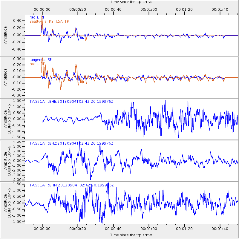
Signal To Noise
| Channel | StoN | STA | LTA |
| TA:S51A: :BHZ:20130904T02:42:20.199976Z | 5.1602283 | 9.3993646E-7 | 1.8215017E-7 |
| TA:S51A: :BHN:20130904T02:42:20.199976Z | 2.798815 | 3.665654E-7 | 1.3097164E-7 |
| TA:S51A: :BHE:20130904T02:42:20.199976Z | 2.0903049 | 2.5792787E-7 | 1.2339247E-7 |
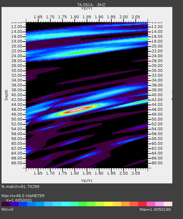
| Arrivals | |
| Ps | 6.0 SECOND |
| PpPs | 19 SECOND |
| PsPs/PpSs | 25 SECOND |

