S52A Salyersville, KY, USA - Earthquake Result Viewer
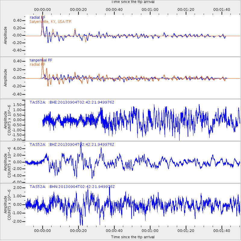
Earthquake location: Andreanof Islands, Aleutian Is.
Earthquake latitude/longitude: 51.6/-174.8
Earthquake time(UTC): 2013/09/04 (247) 02:32:30 GMT
Earthquake Depth: 20 km
Earthquake Magnitude: 6.5 MWW, 5.9 ML, 6.3 MWB, 6.5 MI, 6.5 MWC, 6.5 MWW
Earthquake Catalog/Contributor: NEIC PDE/NEIC COMCAT
Network: TA USArray Transportable Network (new EarthScope stations)
Station: S52A Salyersville, KY, USA
Lat/Lon: 37.68 N/83.08 W
Elevation: 367 m
Distance: 62.6 deg
Az: 63.336 deg
Baz: 315.319 deg
Ray Param: 0.06012658
Estimated Moho Depth: 19.75 km
Estimated Crust Vp/Vs: 1.70
Assumed Crust Vp: 6.476 km/s
Estimated Crust Vs: 3.804 km/s
Estimated Crust Poisson's Ratio: 0.24
Radial Match: 89.842804 %
Radial Bump: 400
Transverse Match: 79.92967 %
Transverse Bump: 400
SOD ConfigId: 626651
Insert Time: 2014-04-18 10:20:27.956 +0000
GWidth: 2.5
Max Bumps: 400
Tol: 0.001

Signal To Noise

ChannelStoNSTALTA
TA:S52A: :BHZ:20130904T02:42:21.949976Z4.9607561.3321254E-62.6853274E-7
TA:S52A: :BHN:20130904T02:42:21.949976Z1.85244424.994282E-72.6960498E-7
TA:S52A: :BHE:20130904T02:42:21.949976Z1.77617495.4955586E-73.0940413E-7
Arrivals
Ps2.2 SECOND
PpPs7.9 SECOND
PsPs/PpSs10 SECOND