You are here: Home > Network List > G - GEOSCOPE Stations List
> Station INU Inuyama, Japan > Earthquake Result Viewer
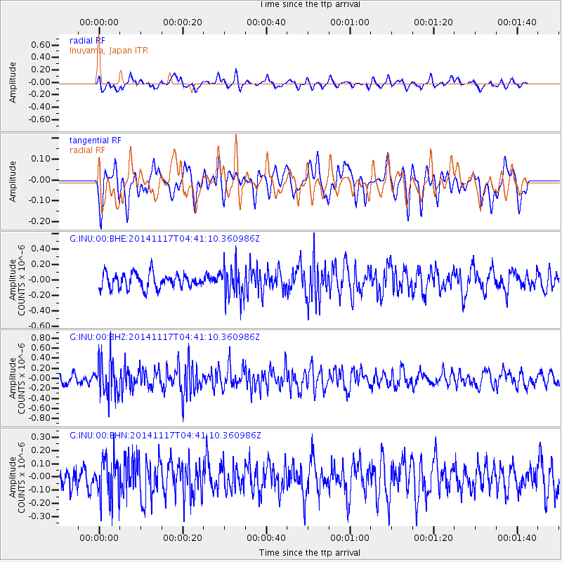
INU Inuyama, Japan - Earthquake Result Viewer
*The percent match for this event was below the threshold and hence no stack was calculated.
| Earthquake location: |
Myanmar |
| Earthquake latitude/longitude: |
20.8/94.4 |
| Earthquake time(UTC): |
2014/11/17 (321) 04:34:13 GMT |
| Earthquake Depth: |
76 km |
| Earthquake Magnitude: |
5.3 MW, 5.5 mb |
| Earthquake Catalog/Contributor: |
ISC/ISC |
|
| Network: |
G GEOSCOPE |
| Station: |
INU Inuyama, Japan |
| Lat/Lon: |
35.35 N/137.03 E |
| Elevation: |
132 m |
|
| Distance: |
40.0 deg |
| Az: |
59.441 deg |
| Baz: |
260.303 deg |
| Ray Param: |
$rayparam |
*The percent match for this event was below the threshold and hence was not used in the summary stack. |
|
| Radial Match: |
51.187 % |
| Radial Bump: |
400 |
| Transverse Match: |
54.091755 % |
| Transverse Bump: |
400 |
| SOD ConfigId: |
3390531 |
| Insert Time: |
2019-04-15 01:22:03.439 +0000 |
| GWidth: |
2.5 |
| Max Bumps: |
400 |
| Tol: |
0.001 |
|
Signal To Noise
| Channel | StoN | STA | LTA |
| G:INU:00:BHZ:20141117T04:41:10.360986Z | 2.5745273 | 3.6340163E-7 | 1.4115277E-7 |
| G:INU:00:BHN:20141117T04:41:10.360986Z | 2.6096244 | 1.588701E-7 | 6.087853E-8 |
| G:INU:00:BHE:20141117T04:41:10.360986Z | 2.1357727 | 2.0264252E-7 | 9.488019E-8 |
| Arrivals |
| Ps | |
| PpPs | |
| PsPs/PpSs | |


