
SFIN Lafayette, IN, USA - Earthquake Result Viewer
| ||||||||||||||||||
| ||||||||||||||||||
| ||||||||||||||||||
|
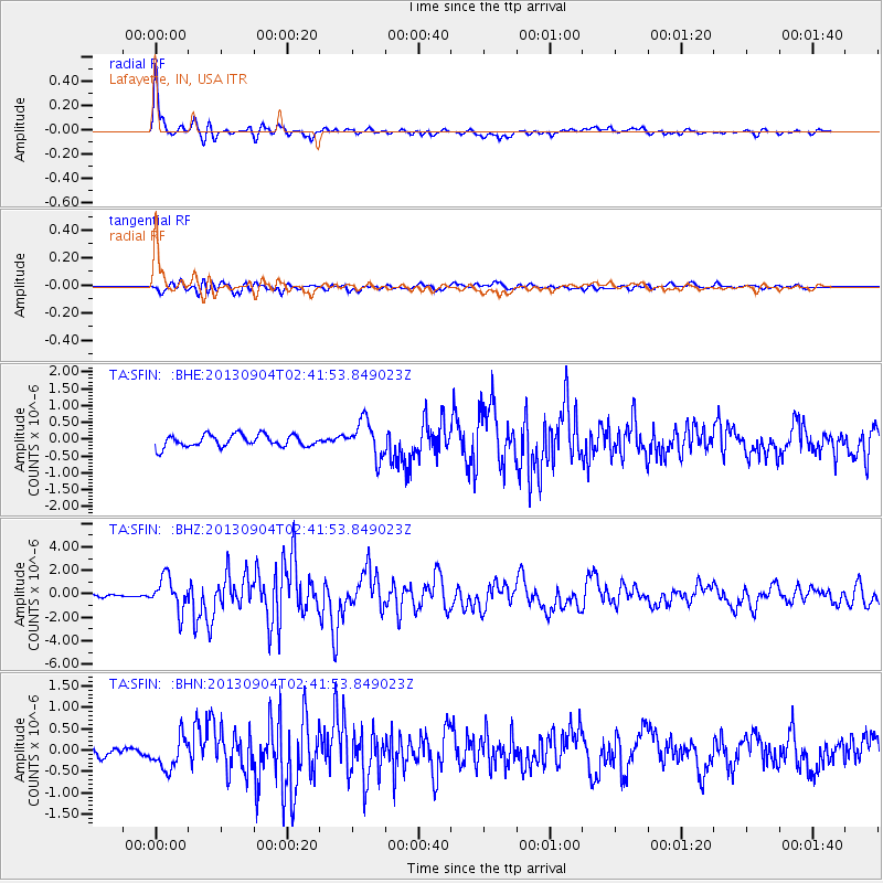
Signal To Noise
| Channel | StoN | STA | LTA |
| TA:SFIN: :BHZ:20130904T02:41:53.849023Z | 8.917008 | 1.4026458E-6 | 1.5730004E-7 |
| TA:SFIN: :BHN:20130904T02:41:53.849023Z | 2.7100847 | 3.6992333E-7 | 1.3649881E-7 |
| TA:SFIN: :BHE:20130904T02:41:53.849023Z | 3.012834 | 5.42396E-7 | 1.8002851E-7 |
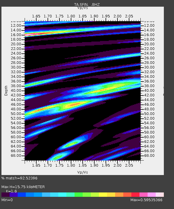
| Arrivals | |
| Ps | 1.5 SECOND |
| PpPs | 6.0 SECOND |
| PsPs/PpSs | 7.5 SECOND |

