T50A Nancy, KY, USA - Earthquake Result Viewer
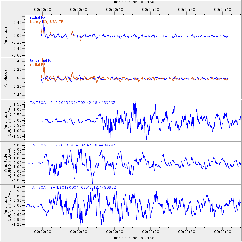
Earthquake location: Andreanof Islands, Aleutian Is.
Earthquake latitude/longitude: 51.6/-174.8
Earthquake time(UTC): 2013/09/04 (247) 02:32:30 GMT
Earthquake Depth: 20 km
Earthquake Magnitude: 6.5 MWW, 5.9 ML, 6.3 MWB, 6.5 MI, 6.5 MWC, 6.5 MWW
Earthquake Catalog/Contributor: NEIC PDE/NEIC COMCAT
Network: TA USArray Transportable Network (new EarthScope stations)
Station: T50A Nancy, KY, USA
Lat/Lon: 37.02 N/84.84 W
Elevation: 302 m
Distance: 62.0 deg
Az: 64.983 deg
Baz: 315.022 deg
Ray Param: 0.060471952
Estimated Moho Depth: 38.75 km
Estimated Crust Vp/Vs: 1.88
Assumed Crust Vp: 6.476 km/s
Estimated Crust Vs: 3.449 km/s
Estimated Crust Poisson's Ratio: 0.30
Radial Match: 94.40795 %
Radial Bump: 369
Transverse Match: 82.44624 %
Transverse Bump: 400
SOD ConfigId: 626651
Insert Time: 2014-04-18 10:21:03.821 +0000
GWidth: 2.5
Max Bumps: 400
Tol: 0.001

Signal To Noise

ChannelStoNSTALTA
TA:T50A: :BHZ:20130904T02:42:18.448999Z11.7672861.2182154E-61.035256E-7
TA:T50A: :BHN:20130904T02:42:18.448999Z3.17523863.1494628E-79.918822E-8
TA:T50A: :BHE:20130904T02:42:18.448999Z3.56233384.1019698E-71.15148374E-7
Arrivals
Ps5.5 SECOND
PpPs16 SECOND
PsPs/PpSs22 SECOND