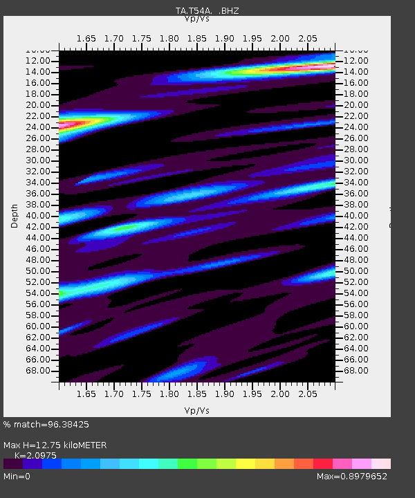
T54A Tazewell, VA, USA - Earthquake Result Viewer
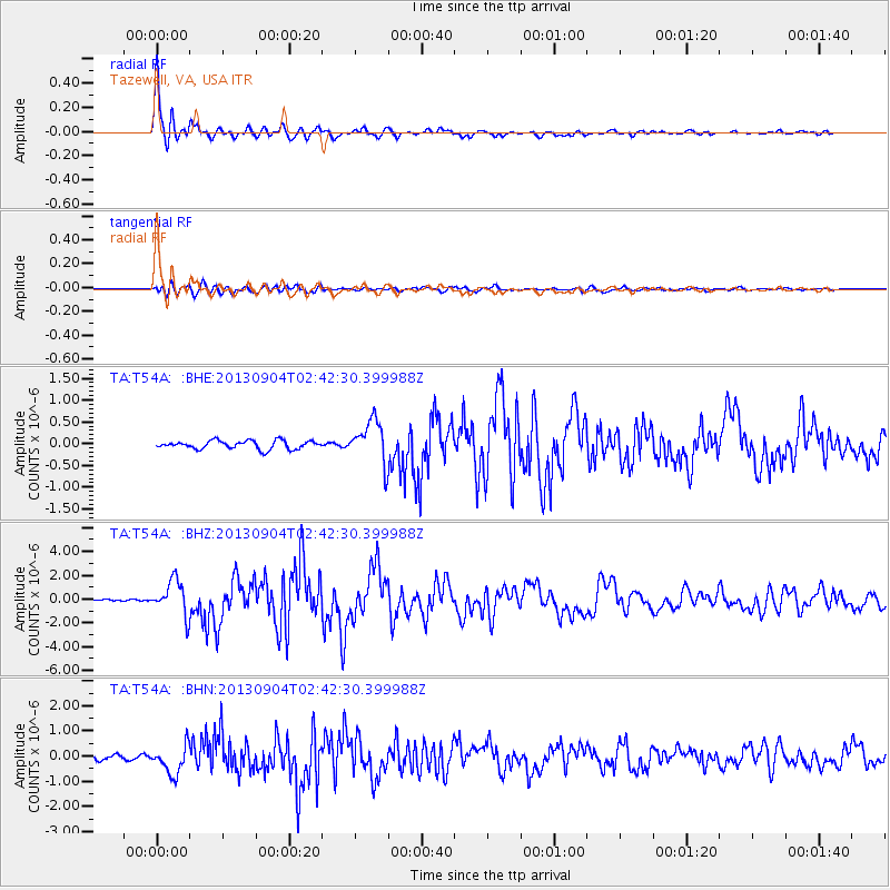
Earthquake location: Andreanof Islands, Aleutian Is.
Earthquake latitude/longitude: 51.6/-174.8
Earthquake time(UTC): 2013/09/04 (247) 02:32:30 GMT
Earthquake Depth: 20 km
Earthquake Magnitude: 6.5 MWW, 5.9 ML, 6.3 MWB, 6.5 MI, 6.5 MWC, 6.5 MWW
Earthquake Catalog/Contributor: NEIC PDE/NEIC COMCAT
Network: TA USArray Transportable Network (new EarthScope stations)
Station: T54A Tazewell, VA, USA
Lat/Lon: 37.06 N/81.58 W
Elevation: 852 m
Distance: 63.8 deg
Az: 62.86 deg
Baz: 316.013 deg
Ray Param: 0.059296846
Estimated Moho Depth: 12.75 km
Estimated Crust Vp/Vs: 2.10
Assumed Crust Vp: 6.159 km/s
Estimated Crust Vs: 2.936 km/s
Estimated Crust Poisson's Ratio: 0.35
Radial Match: 96.38425 %
Radial Bump: 400
Transverse Match: 83.592445 %
Transverse Bump: 400
SOD ConfigId: 626651
Insert Time: 2014-04-18 10:21:12.776 +0000
GWidth: 2.5
Max Bumps: 400
Tol: 0.001

Signal To Noise

ChannelStoNSTALTA
TA:T54A: :BHZ:20130904T02:42:30.399988Z14.81441.4613448E-69.864354E-8
TA:T54A: :BHN:20130904T02:42:30.399988Z6.4018425.8050915E-79.0678455E-8
TA:T54A: :BHE:20130904T02:42:30.399988Z5.0853984.893423E-79.622498E-8
Arrivals
Ps2.3 SECOND
PpPs6.2 SECOND
PsPs/PpSs8.6 SECOND