U50A Jamestown, TN, USA - Earthquake Result Viewer
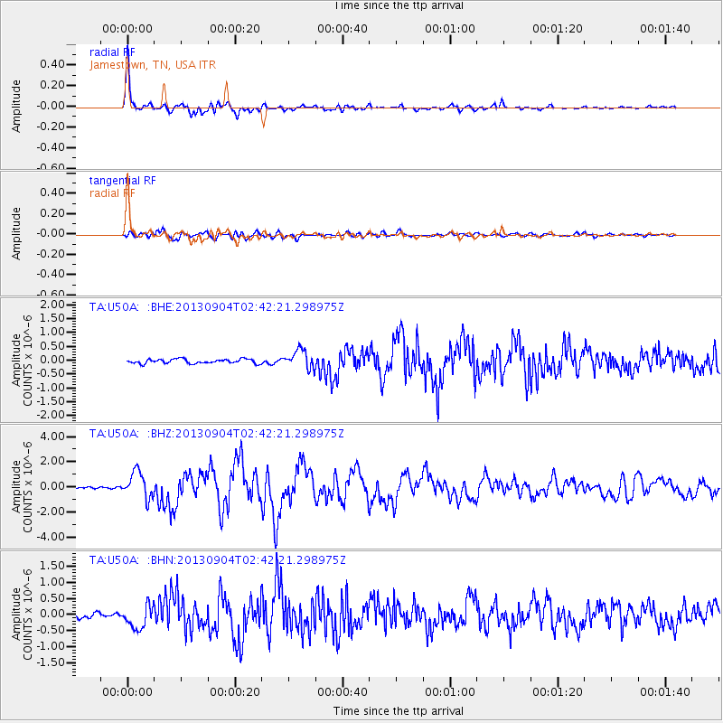
Earthquake location: Andreanof Islands, Aleutian Is.
Earthquake latitude/longitude: 51.6/-174.8
Earthquake time(UTC): 2013/09/04 (247) 02:32:30 GMT
Earthquake Depth: 20 km
Earthquake Magnitude: 6.5 MWW, 5.9 ML, 6.3 MWB, 6.5 MI, 6.5 MWC, 6.5 MWW
Earthquake Catalog/Contributor: NEIC PDE/NEIC COMCAT
Network: TA USArray Transportable Network (new EarthScope stations)
Station: U50A Jamestown, TN, USA
Lat/Lon: 36.42 N/84.84 W
Elevation: 474 m
Distance: 62.5 deg
Az: 65.467 deg
Baz: 315.245 deg
Ray Param: 0.06019048
Estimated Moho Depth: 22.0 km
Estimated Crust Vp/Vs: 2.10
Assumed Crust Vp: 6.476 km/s
Estimated Crust Vs: 3.087 km/s
Estimated Crust Poisson's Ratio: 0.35
Radial Match: 94.16608 %
Radial Bump: 400
Transverse Match: 80.168434 %
Transverse Bump: 400
SOD ConfigId: 626651
Insert Time: 2014-04-18 10:21:39.562 +0000
GWidth: 2.5
Max Bumps: 400
Tol: 0.001

Signal To Noise

ChannelStoNSTALTA
TA:U50A: :BHZ:20130904T02:42:21.298975Z10.1550811.0554122E-61.0392947E-7
TA:U50A: :BHN:20130904T02:42:21.298975Z3.86533833.619356E-79.36362E-8
TA:U50A: :BHE:20130904T02:42:21.298975Z4.21583.3176727E-77.869616E-8
Arrivals
Ps3.9 SECOND
PpPs10 SECOND
PsPs/PpSs14 SECOND