U53A Fall Branch, TN, USA - Earthquake Result Viewer
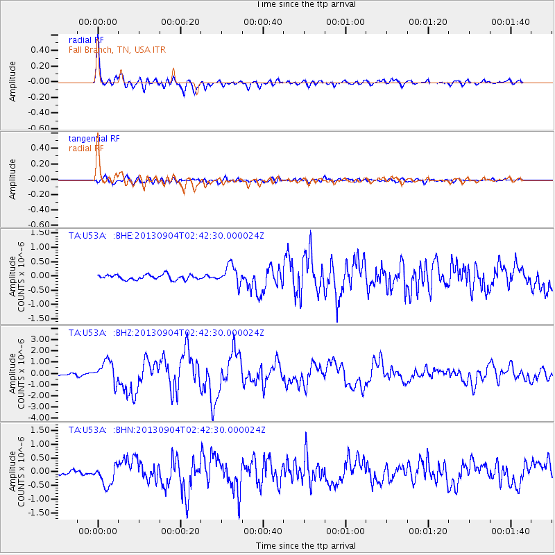
Earthquake location: Andreanof Islands, Aleutian Is.
Earthquake latitude/longitude: 51.6/-174.8
Earthquake time(UTC): 2013/09/04 (247) 02:32:30 GMT
Earthquake Depth: 20 km
Earthquake Magnitude: 6.5 MWW, 5.9 ML, 6.3 MWB, 6.5 MI, 6.5 MWC, 6.5 MWW
Earthquake Catalog/Contributor: NEIC PDE/NEIC COMCAT
Network: TA USArray Transportable Network (new EarthScope stations)
Station: U53A Fall Branch, TN, USA
Lat/Lon: 36.36 N/82.58 W
Elevation: 559 m
Distance: 63.8 deg
Az: 64.043 deg
Baz: 315.939 deg
Ray Param: 0.059335873
Estimated Moho Depth: 45.5 km
Estimated Crust Vp/Vs: 1.72
Assumed Crust Vp: 6.476 km/s
Estimated Crust Vs: 3.76 km/s
Estimated Crust Poisson's Ratio: 0.25
Radial Match: 95.09679 %
Radial Bump: 400
Transverse Match: 78.86218 %
Transverse Bump: 400
SOD ConfigId: 626651
Insert Time: 2014-04-18 10:21:48.868 +0000
GWidth: 2.5
Max Bumps: 400
Tol: 0.001

Signal To Noise

ChannelStoNSTALTA
TA:U53A: :BHZ:20130904T02:42:30.000024Z7.49426031.0128563E-61.3515094E-7
TA:U53A: :BHN:20130904T02:42:30.000024Z3.90711863.8571235E-79.872041E-8
TA:U53A: :BHE:20130904T02:42:30.000024Z4.0237053.4374665E-78.543038E-8
Arrivals
Ps5.3 SECOND
PpPs18 SECOND
PsPs/PpSs24 SECOND