
U55A TA2, Sparta, NC, USA - Earthquake Result Viewer
| ||||||||||||||||||
| ||||||||||||||||||
| ||||||||||||||||||
|
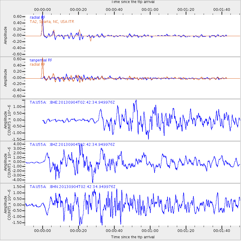
Signal To Noise
| Channel | StoN | STA | LTA |
| TA:U55A: :BHZ:20130904T02:42:34.949976Z | 13.906425 | 1.2026404E-6 | 8.648092E-8 |
| TA:U55A: :BHN:20130904T02:42:34.949976Z | 4.827242 | 4.25195E-7 | 8.808239E-8 |
| TA:U55A: :BHE:20130904T02:42:34.949976Z | 5.7876673 | 4.421047E-7 | 7.6387366E-8 |
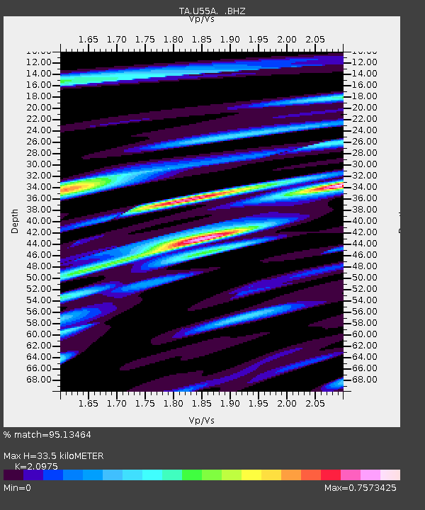
| Arrivals | |
| Ps | 6.2 SECOND |
| PpPs | 16 SECOND |
| PsPs/PpSs | 22 SECOND |

