U59A Littleton, NC, USA - Earthquake Result Viewer
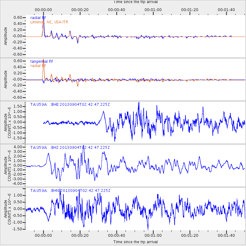
Earthquake location: Andreanof Islands, Aleutian Is.
Earthquake latitude/longitude: 51.6/-174.8
Earthquake time(UTC): 2013/09/04 (247) 02:32:30 GMT
Earthquake Depth: 20 km
Earthquake Magnitude: 6.5 MWW, 5.9 ML, 6.3 MWB, 6.5 MI, 6.5 MWC, 6.5 MWW
Earthquake Catalog/Contributor: NEIC PDE/NEIC COMCAT
Network: TA USArray Transportable Network (new EarthScope stations)
Station: U59A Littleton, NC, USA
Lat/Lon: 36.35 N/77.79 W
Elevation: 99 m
Distance: 66.4 deg
Az: 60.954 deg
Baz: 317.463 deg
Ray Param: 0.05759938
Estimated Moho Depth: 36.25 km
Estimated Crust Vp/Vs: 1.75
Assumed Crust Vp: 6.565 km/s
Estimated Crust Vs: 3.746 km/s
Estimated Crust Poisson's Ratio: 0.26
Radial Match: 97.01512 %
Radial Bump: 304
Transverse Match: 83.362045 %
Transverse Bump: 400
SOD ConfigId: 626651
Insert Time: 2014-04-18 10:22:02.861 +0000
GWidth: 2.5
Max Bumps: 400
Tol: 0.001

Signal To Noise

ChannelStoNSTALTA
TA:U59A: :BHZ:20130904T02:42:47.225Z14.5196611.3368987E-69.2075055E-8
TA:U59A: :BHN:20130904T02:42:47.225Z5.5675954.3064426E-77.7348346E-8
TA:U59A: :BHE:20130904T02:42:47.225Z6.6107055.393569E-78.158842E-8
Arrivals
Ps4.3 SECOND
PpPs15 SECOND
PsPs/PpSs19 SECOND