V50A Pikevile, TN, USA - Earthquake Result Viewer
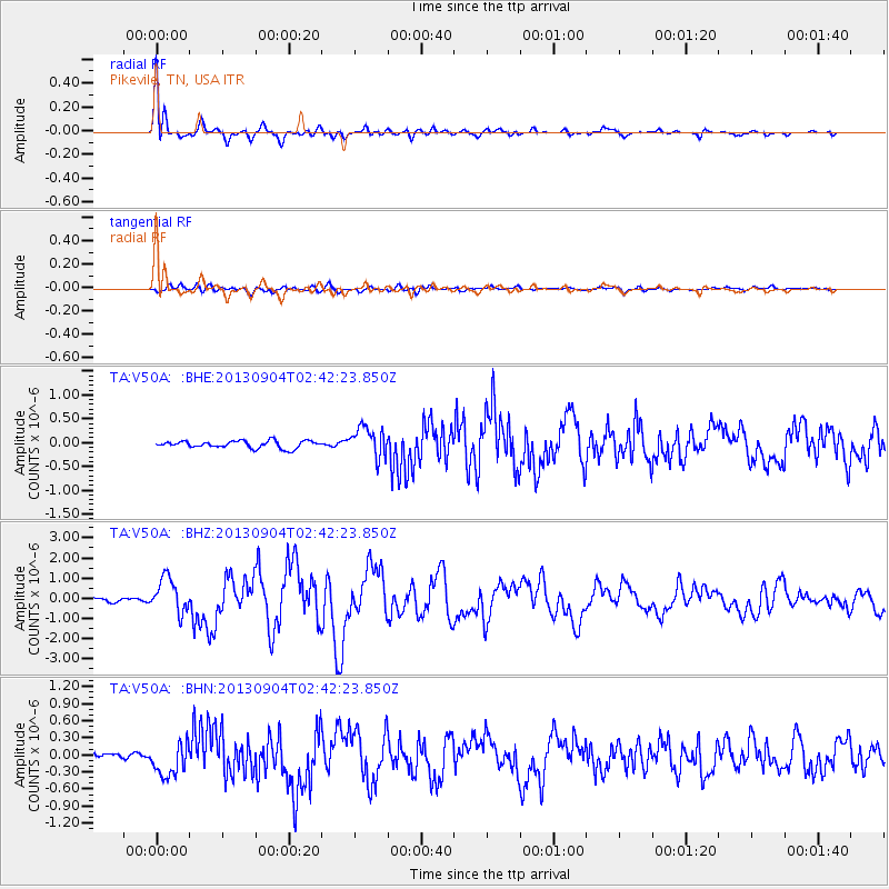
Earthquake location: Andreanof Islands, Aleutian Is.
Earthquake latitude/longitude: 51.6/-174.8
Earthquake time(UTC): 2013/09/04 (247) 02:32:30 GMT
Earthquake Depth: 20 km
Earthquake Magnitude: 6.5 MWW, 5.9 ML, 6.3 MWB, 6.5 MI, 6.5 MWC, 6.5 MWW
Earthquake Catalog/Contributor: NEIC PDE/NEIC COMCAT
Network: TA USArray Transportable Network (new EarthScope stations)
Station: V50A Pikevile, TN, USA
Lat/Lon: 35.67 N/85.10 W
Elevation: 287 m
Distance: 62.8 deg
Az: 66.222 deg
Baz: 315.441 deg
Ray Param: 0.059942365
Estimated Moho Depth: 46.0 km
Estimated Crust Vp/Vs: 1.88
Assumed Crust Vp: 6.35 km/s
Estimated Crust Vs: 3.369 km/s
Estimated Crust Poisson's Ratio: 0.30
Radial Match: 93.85266 %
Radial Bump: 400
Transverse Match: 72.95924 %
Transverse Bump: 400
SOD ConfigId: 626651
Insert Time: 2014-04-18 10:22:12.226 +0000
GWidth: 2.5
Max Bumps: 400
Tol: 0.001

Signal To Noise

ChannelStoNSTALTA
TA:V50A: :BHZ:20130904T02:42:23.850Z11.943228.5796125E-77.183668E-8
TA:V50A: :BHN:20130904T02:42:23.850Z3.93131972.874619E-77.3120965E-8
TA:V50A: :BHE:20130904T02:42:23.850Z4.11400133.116034E-77.574218E-8
Arrivals
Ps6.7 SECOND
PpPs20 SECOND
PsPs/PpSs27 SECOND