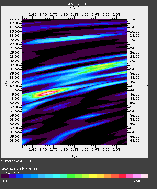
V55A Taylorsville, NC, USA - Earthquake Result Viewer
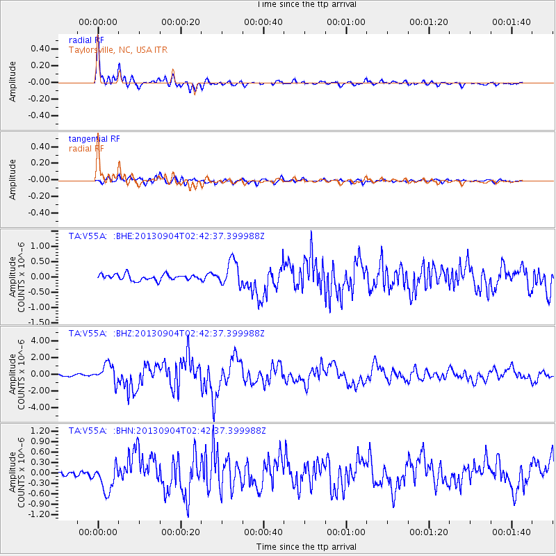
Earthquake location: Andreanof Islands, Aleutian Is.
Earthquake latitude/longitude: 51.6/-174.8
Earthquake time(UTC): 2013/09/04 (247) 02:32:30 GMT
Earthquake Depth: 20 km
Earthquake Magnitude: 6.5 MWW, 5.9 ML, 6.3 MWB, 6.5 MI, 6.5 MWC, 6.5 MWW
Earthquake Catalog/Contributor: NEIC PDE/NEIC COMCAT
Network: TA USArray Transportable Network (new EarthScope stations)
Station: V55A Taylorsville, NC, USA
Lat/Lon: 35.85 N/81.21 W
Elevation: 306 m
Distance: 64.9 deg
Az: 63.552 deg
Baz: 316.526 deg
Ray Param: 0.058599368
Estimated Moho Depth: 45.0 km
Estimated Crust Vp/Vs: 1.73
Assumed Crust Vp: 6.419 km/s
Estimated Crust Vs: 3.721 km/s
Estimated Crust Poisson's Ratio: 0.25
Radial Match: 94.36646 %
Radial Bump: 400
Transverse Match: 84.86721 %
Transverse Bump: 400
SOD ConfigId: 626651
Insert Time: 2014-04-18 10:22:25.887 +0000
GWidth: 2.5
Max Bumps: 400
Tol: 0.001

Signal To Noise

ChannelStoNSTALTA
TA:V55A: :BHZ:20130904T02:42:37.399988Z10.8171711.1360037E-61.0501856E-7
TA:V55A: :BHN:20130904T02:42:37.399988Z4.78585433.8645396E-78.074921E-8
TA:V55A: :BHE:20130904T02:42:37.399988Z4.3530824.1600694E-79.556607E-8
Arrivals
Ps5.3 SECOND
PpPs18 SECOND
PsPs/PpSs24 SECOND