V56A Mocksville, NC, USA - Earthquake Result Viewer
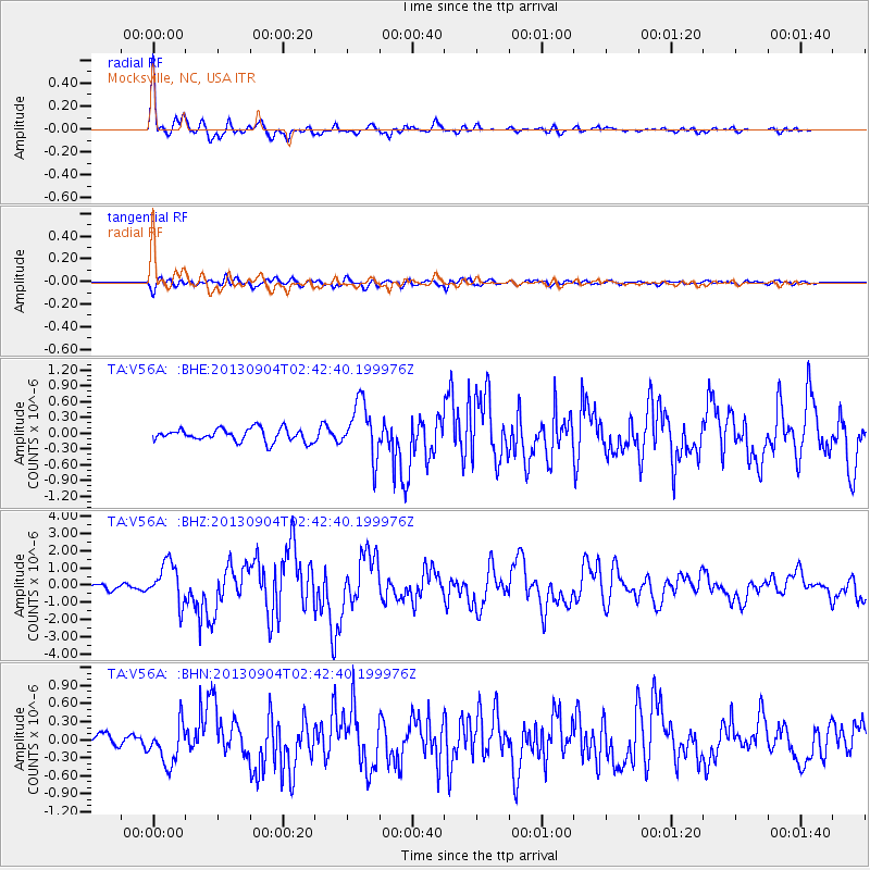
Earthquake location: Andreanof Islands, Aleutian Is.
Earthquake latitude/longitude: 51.6/-174.8
Earthquake time(UTC): 2013/09/04 (247) 02:32:30 GMT
Earthquake Depth: 20 km
Earthquake Magnitude: 6.5 MWW, 5.9 ML, 6.3 MWB, 6.5 MI, 6.5 MWC, 6.5 MWW
Earthquake Catalog/Contributor: NEIC PDE/NEIC COMCAT
Network: TA USArray Transportable Network (new EarthScope stations)
Station: V56A Mocksville, NC, USA
Lat/Lon: 35.81 N/80.50 W
Elevation: 237 m
Distance: 65.3 deg
Az: 63.116 deg
Baz: 316.761 deg
Ray Param: 0.05831613
Estimated Moho Depth: 40.25 km
Estimated Crust Vp/Vs: 1.70
Assumed Crust Vp: 6.419 km/s
Estimated Crust Vs: 3.77 km/s
Estimated Crust Poisson's Ratio: 0.24
Radial Match: 94.13759 %
Radial Bump: 400
Transverse Match: 76.41078 %
Transverse Bump: 400
SOD ConfigId: 626651
Insert Time: 2014-04-18 10:22:26.160 +0000
GWidth: 2.5
Max Bumps: 400
Tol: 0.001

Signal To Noise

ChannelStoNSTALTA
TA:V56A: :BHZ:20130904T02:42:40.199976Z9.5967471.176713E-61.2261582E-7
TA:V56A: :BHN:20130904T02:42:40.199976Z2.95815683.3139358E-71.1202705E-7
TA:V56A: :BHE:20130904T02:42:40.199976Z4.26255945.1925895E-71.2181859E-7
Arrivals
Ps4.6 SECOND
PpPs16 SECOND
PsPs/PpSs21 SECOND