W49A Belvidere, TN, USA - Earthquake Result Viewer
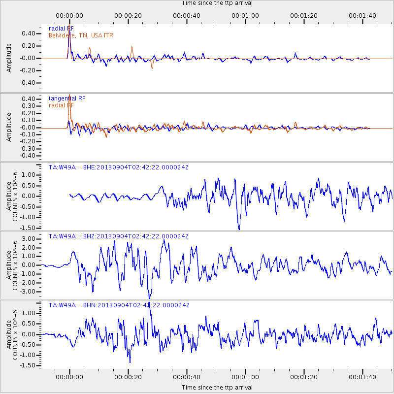
Earthquake location: Andreanof Islands, Aleutian Is.
Earthquake latitude/longitude: 51.6/-174.8
Earthquake time(UTC): 2013/09/04 (247) 02:32:30 GMT
Earthquake Depth: 20 km
Earthquake Magnitude: 6.5 MWW, 5.9 ML, 6.3 MWB, 6.5 MI, 6.5 MWC, 6.5 MWW
Earthquake Catalog/Contributor: NEIC PDE/NEIC COMCAT
Network: TA USArray Transportable Network (new EarthScope stations)
Station: W49A Belvidere, TN, USA
Lat/Lon: 35.12 N/86.26 W
Elevation: 251 m
Distance: 62.6 deg
Az: 67.419 deg
Baz: 315.318 deg
Ray Param: 0.060121235
Estimated Moho Depth: 25.0 km
Estimated Crust Vp/Vs: 1.69
Assumed Crust Vp: 6.476 km/s
Estimated Crust Vs: 3.832 km/s
Estimated Crust Poisson's Ratio: 0.23
Radial Match: 92.54033 %
Radial Bump: 400
Transverse Match: 84.10475 %
Transverse Bump: 400
SOD ConfigId: 626651
Insert Time: 2014-04-18 10:22:48.871 +0000
GWidth: 2.5
Max Bumps: 400
Tol: 0.001

Signal To Noise

ChannelStoNSTALTA
TA:W49A: :BHZ:20130904T02:42:22.000024Z6.96144729.621167E-71.3820643E-7
TA:W49A: :BHN:20130904T02:42:22.000024Z2.71454292.9542588E-71.08830804E-7
TA:W49A: :BHE:20130904T02:42:22.000024Z3.04149872.8215706E-79.2769085E-8
Arrivals
Ps2.8 SECOND
PpPs9.9 SECOND
PsPs/PpSs13 SECOND