W50A Signal Mountain, TN, USA - Earthquake Result Viewer
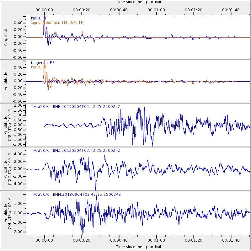
Earthquake location: Andreanof Islands, Aleutian Is.
Earthquake latitude/longitude: 51.6/-174.8
Earthquake time(UTC): 2013/09/04 (247) 02:32:30 GMT
Earthquake Depth: 20 km
Earthquake Magnitude: 6.5 MWW, 5.9 ML, 6.3 MWB, 6.5 MI, 6.5 MWC, 6.5 MWW
Earthquake Catalog/Contributor: NEIC PDE/NEIC COMCAT
Network: TA USArray Transportable Network (new EarthScope stations)
Station: W50A Signal Mountain, TN, USA
Lat/Lon: 35.20 N/85.31 W
Elevation: 587 m
Distance: 63.1 deg
Az: 66.731 deg
Baz: 315.55 deg
Ray Param: 0.05980389
Estimated Moho Depth: 47.25 km
Estimated Crust Vp/Vs: 1.86
Assumed Crust Vp: 6.35 km/s
Estimated Crust Vs: 3.423 km/s
Estimated Crust Poisson's Ratio: 0.30
Radial Match: 95.13491 %
Radial Bump: 400
Transverse Match: 73.46861 %
Transverse Bump: 400
SOD ConfigId: 626651
Insert Time: 2014-04-18 10:22:51.151 +0000
GWidth: 2.5
Max Bumps: 400
Tol: 0.001

Signal To Noise

ChannelStoNSTALTA
TA:W50A: :BHZ:20130904T02:42:25.250024Z11.6379431.1165648E-69.5941765E-8
TA:W50A: :BHN:20130904T02:42:25.250024Z5.41883953.4777563E-76.4178984E-8
TA:W50A: :BHE:20130904T02:42:25.250024Z5.10789635.125739E-71.0034931E-7
Arrivals
Ps6.6 SECOND
PpPs20 SECOND
PsPs/PpSs27 SECOND