W53A Cullowhee, NC, USA - Earthquake Result Viewer
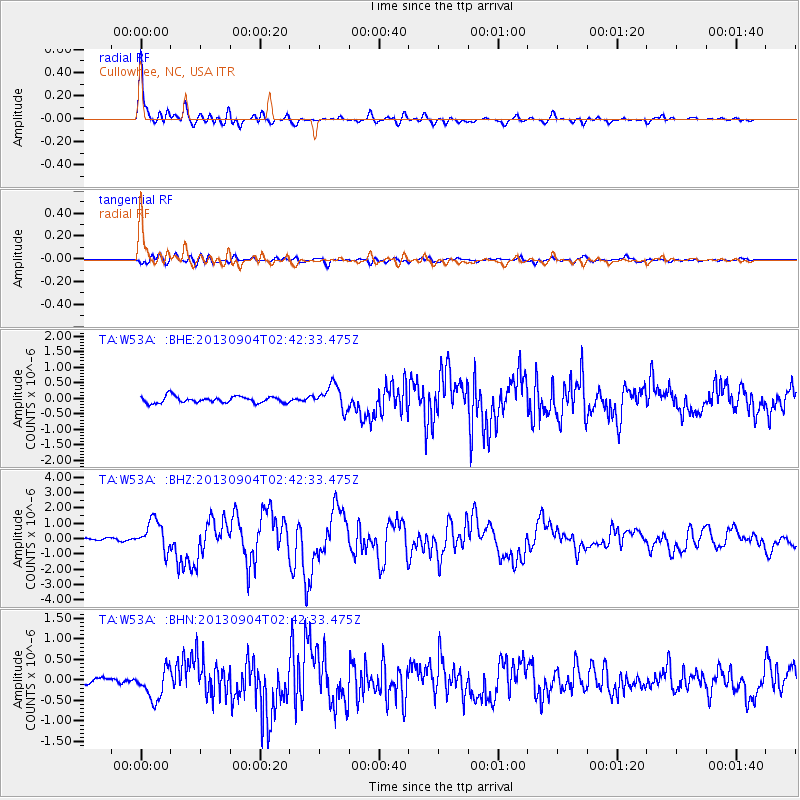
Earthquake location: Andreanof Islands, Aleutian Is.
Earthquake latitude/longitude: 51.6/-174.8
Earthquake time(UTC): 2013/09/04 (247) 02:32:30 GMT
Earthquake Depth: 20 km
Earthquake Magnitude: 6.5 MWW, 5.9 ML, 6.3 MWB, 6.5 MI, 6.5 MWC, 6.5 MWW
Earthquake Catalog/Contributor: NEIC PDE/NEIC COMCAT
Network: TA USArray Transportable Network (new EarthScope stations)
Station: W53A Cullowhee, NC, USA
Lat/Lon: 35.17 N/83.16 W
Elevation: 1180 m
Distance: 64.3 deg
Az: 65.345 deg
Baz: 316.168 deg
Ray Param: 0.058987923
Estimated Moho Depth: 44.25 km
Estimated Crust Vp/Vs: 2.04
Assumed Crust Vp: 6.35 km/s
Estimated Crust Vs: 3.12 km/s
Estimated Crust Poisson's Ratio: 0.34
Radial Match: 93.6224 %
Radial Bump: 400
Transverse Match: 80.596306 %
Transverse Bump: 400
SOD ConfigId: 626651
Insert Time: 2014-04-18 10:22:58.066 +0000
GWidth: 2.5
Max Bumps: 400
Tol: 0.001

Signal To Noise

ChannelStoNSTALTA
TA:W53A: :BHZ:20130904T02:42:33.475Z9.3518379.786907E-71.0465223E-7
TA:W53A: :BHN:20130904T02:42:33.475Z3.8405693.7293785E-79.7104845E-8
TA:W53A: :BHE:20130904T02:42:33.475Z3.68246583.8209964E-71.037619E-7
Arrivals
Ps7.5 SECOND
PpPs20 SECOND
PsPs/PpSs28 SECOND