WHTX Lake Whitney, Meridian, TX, USA - Earthquake Result Viewer
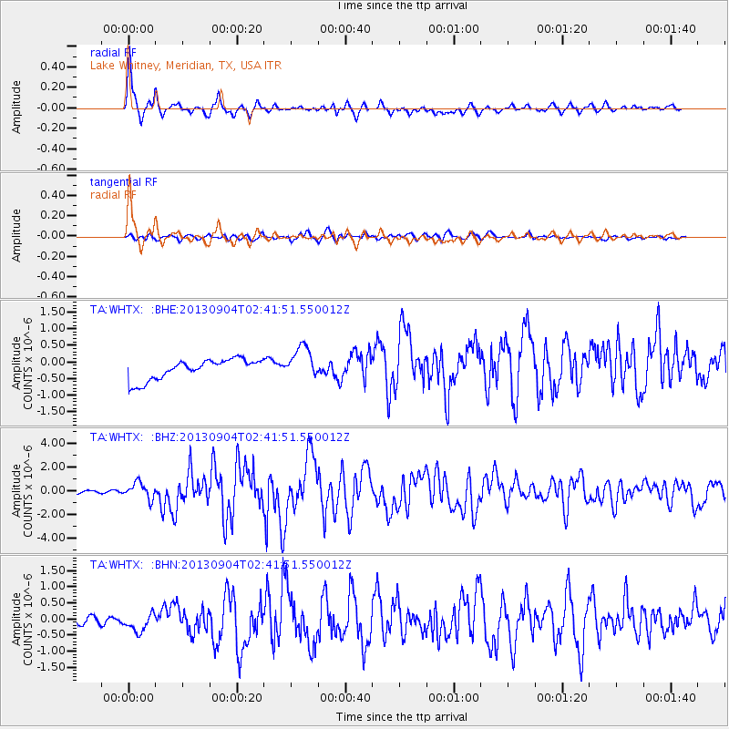
Earthquake location: Andreanof Islands, Aleutian Is.
Earthquake latitude/longitude: 51.6/-174.8
Earthquake time(UTC): 2013/09/04 (247) 02:32:30 GMT
Earthquake Depth: 20 km
Earthquake Magnitude: 6.5 MWW, 5.9 ML, 6.3 MWB, 6.5 MI, 6.5 MWC, 6.5 MWW
Earthquake Catalog/Contributor: NEIC PDE/NEIC COMCAT
Network: TA USArray Transportable Network (new EarthScope stations)
Station: WHTX Lake Whitney, Meridian, TX, USA
Lat/Lon: 31.99 N/97.46 W
Elevation: 190 m
Distance: 58.1 deg
Az: 77.529 deg
Baz: 314.162 deg
Ray Param: 0.06303962
Estimated Moho Depth: 13.25 km
Estimated Crust Vp/Vs: 1.60
Assumed Crust Vp: 6.347 km/s
Estimated Crust Vs: 3.967 km/s
Estimated Crust Poisson's Ratio: 0.18
Radial Match: 91.69169 %
Radial Bump: 370
Transverse Match: 72.01671 %
Transverse Bump: 400
SOD ConfigId: 626651
Insert Time: 2014-04-18 10:23:16.445 +0000
GWidth: 2.5
Max Bumps: 400
Tol: 0.001

Signal To Noise

ChannelStoNSTALTA
TA:WHTX: :BHZ:20130904T02:41:51.550012Z6.32388456.963849E-71.10119814E-7
TA:WHTX: :BHN:20130904T02:41:51.550012Z2.75160242.9273784E-71.06388136E-7
TA:WHTX: :BHE:20130904T02:41:51.550012Z1.61456494.953214E-73.067832E-7
Arrivals
Ps1.3 SECOND
PpPs5.1 SECOND
PsPs/PpSs6.5 SECOND