You are here: Home > Network List > TA - USArray Transportable Network (new EarthScope stations) Stations List
> Station A36M Sachs Harbour, NT, CAN > Earthquake Result Viewer
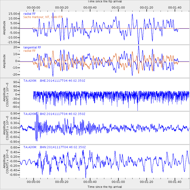
A36M Sachs Harbour, NT, CAN - Earthquake Result Viewer
*The percent match for this event was below the threshold and hence no stack was calculated.
| Earthquake location: |
Myanmar |
| Earthquake latitude/longitude: |
20.8/94.4 |
| Earthquake time(UTC): |
2014/11/17 (321) 04:34:13 GMT |
| Earthquake Depth: |
76 km |
| Earthquake Magnitude: |
5.3 MW, 5.5 mb |
| Earthquake Catalog/Contributor: |
ISC/ISC |
|
| Network: |
TA USArray Transportable Network (new EarthScope stations) |
| Station: |
A36M Sachs Harbour, NT, CAN |
| Lat/Lon: |
71.99 N/125.25 W |
| Elevation: |
32 m |
|
| Distance: |
83.6 deg |
| Az: |
11.523 deg |
| Baz: |
323.071 deg |
| Ray Param: |
$rayparam |
*The percent match for this event was below the threshold and hence was not used in the summary stack. |
|
| Radial Match: |
49.597916 % |
| Radial Bump: |
400 |
| Transverse Match: |
49.63683 % |
| Transverse Bump: |
400 |
| SOD ConfigId: |
3390531 |
| Insert Time: |
2019-04-15 01:23:37.474 +0000 |
| GWidth: |
2.5 |
| Max Bumps: |
400 |
| Tol: |
0.001 |
|
Signal To Noise
| Channel | StoN | STA | LTA |
| TA:A36M: :BHZ:20141117T04:46:02.350Z | 3.6043797 | 3.9511897E-7 | 1.0962191E-7 |
| TA:A36M: :BHN:20141117T04:46:02.350Z | 1.0547454 | 1.7425236E-7 | 1.6520798E-7 |
| TA:A36M: :BHE:20141117T04:46:02.350Z | 0.974891 | 2.2273829E-5 | 2.2847506E-5 |
| Arrivals |
| Ps | |
| PpPs | |
| PsPs/PpSs | |


