X58A Rowland, NC, USA - Earthquake Result Viewer
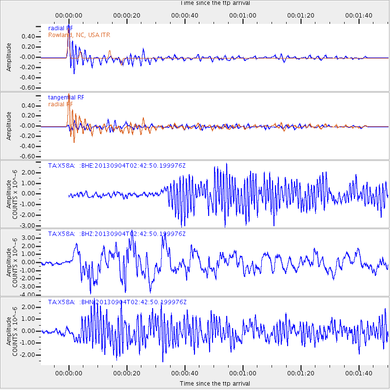
Earthquake location: Andreanof Islands, Aleutian Is.
Earthquake latitude/longitude: 51.6/-174.8
Earthquake time(UTC): 2013/09/04 (247) 02:32:30 GMT
Earthquake Depth: 20 km
Earthquake Magnitude: 6.5 MWW, 5.9 ML, 6.3 MWB, 6.5 MI, 6.5 MWC, 6.5 MWW
Earthquake Catalog/Contributor: NEIC PDE/NEIC COMCAT
Network: TA USArray Transportable Network (new EarthScope stations)
Station: X58A Rowland, NC, USA
Lat/Lon: 34.55 N/79.34 W
Elevation: 45 m
Distance: 66.9 deg
Az: 63.287 deg
Baz: 317.494 deg
Ray Param: 0.05728741
Estimated Moho Depth: 10.0 km
Estimated Crust Vp/Vs: 1.74
Assumed Crust Vp: 6.565 km/s
Estimated Crust Vs: 3.767 km/s
Estimated Crust Poisson's Ratio: 0.25
Radial Match: 89.85253 %
Radial Bump: 400
Transverse Match: 65.76846 %
Transverse Bump: 400
SOD ConfigId: 626651
Insert Time: 2014-04-18 10:23:41.855 +0000
GWidth: 2.5
Max Bumps: 400
Tol: 0.001

Signal To Noise

ChannelStoNSTALTA
TA:X58A: :BHZ:20130904T02:42:50.199976Z11.2619631.243258E-61.1039444E-7
TA:X58A: :BHN:20130904T02:42:50.199976Z4.02082165.4024053E-71.3436073E-7
TA:X58A: :BHE:20130904T02:42:50.199976Z2.68010954.2441667E-71.5835796E-7
Arrivals
Ps1.2 SECOND
PpPs4.0 SECOND
PsPs/PpSs5.2 SECOND