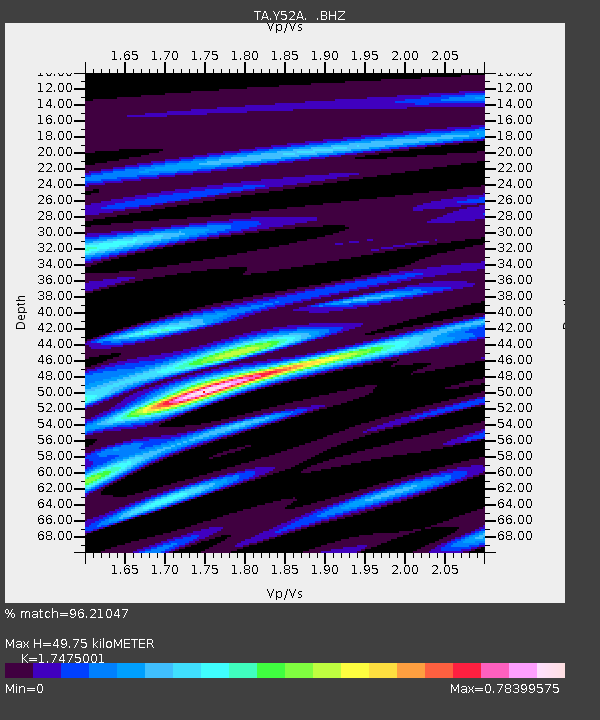
Y52A Lilburn, GA, USA - Earthquake Result Viewer
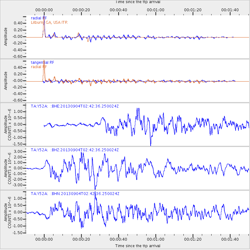
Earthquake location: Andreanof Islands, Aleutian Is.
Earthquake latitude/longitude: 51.6/-174.8
Earthquake time(UTC): 2013/09/04 (247) 02:32:30 GMT
Earthquake Depth: 20 km
Earthquake Magnitude: 6.5 MWW, 5.9 ML, 6.3 MWB, 6.5 MI, 6.5 MWC, 6.5 MWW
Earthquake Catalog/Contributor: NEIC PDE/NEIC COMCAT
Network: TA USArray Transportable Network (new EarthScope stations)
Station: Y52A Lilburn, GA, USA
Lat/Lon: 33.86 N/84.06 W
Elevation: 286 m
Distance: 64.7 deg
Az: 66.937 deg
Baz: 316.346 deg
Ray Param: 0.058714516
Estimated Moho Depth: 49.75 km
Estimated Crust Vp/Vs: 1.75
Assumed Crust Vp: 6.719 km/s
Estimated Crust Vs: 3.845 km/s
Estimated Crust Poisson's Ratio: 0.26
Radial Match: 96.21047 %
Radial Bump: 368
Transverse Match: 77.01764 %
Transverse Bump: 400
SOD ConfigId: 626651
Insert Time: 2014-04-18 10:23:56.946 +0000
GWidth: 2.5
Max Bumps: 400
Tol: 0.001

Signal To Noise

ChannelStoNSTALTA
TA:Y52A: :BHZ:20130904T02:42:36.250024Z10.4798399.004545E-78.592255E-8
TA:Y52A: :BHN:20130904T02:42:36.250024Z4.13134432.795326E-76.766141E-8
TA:Y52A: :BHE:20130904T02:42:36.250024Z5.1330363.4763292E-76.772462E-8
Arrivals
Ps5.8 SECOND
PpPs19 SECOND
PsPs/PpSs25 SECOND