
Y59A Loris, SC, USA - Earthquake Result Viewer
| ||||||||||||||||||
| ||||||||||||||||||
| ||||||||||||||||||
|
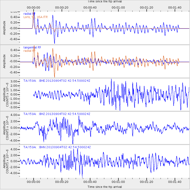
Signal To Noise
| Channel | StoN | STA | LTA |
| TA:Y59A: :BHZ:20130904T02:42:54.500024Z | 3.8966858 | 1.098833E-6 | 2.8199167E-7 |
| TA:Y59A: :BHN:20130904T02:42:54.500024Z | 0.8857005 | 4.597553E-7 | 5.1908665E-7 |
| TA:Y59A: :BHE:20130904T02:42:54.500024Z | 1.15386 | 5.719354E-7 | 4.9567143E-7 |
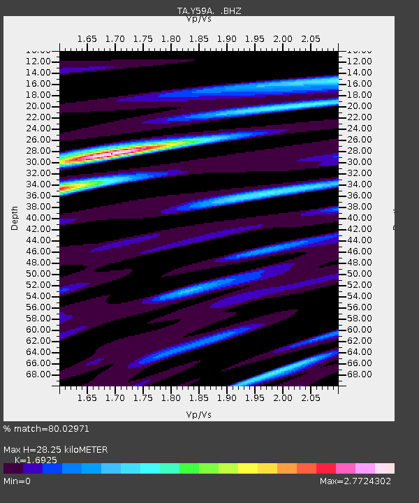
| Arrivals | |
| Ps | 3.3 SECOND |
| PpPs | 12 SECOND |
| PsPs/PpSs | 15 SECOND |

