
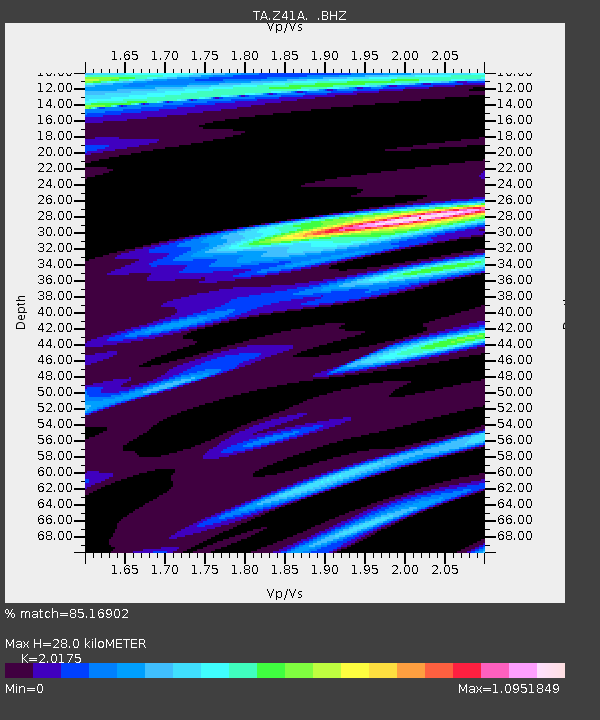
Z41A Richland Creek Farm, El Dorado, AR, USA - Earthquake Result Viewer
| ||||||||||||||||||
| ||||||||||||||||||
| ||||||||||||||||||
|
Signal To Noise
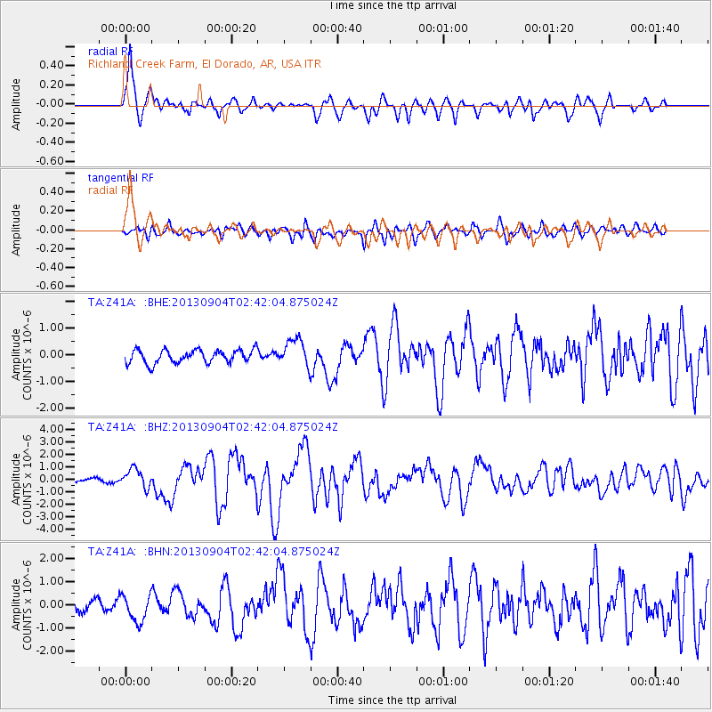
| Channel | StoN | STA | LTA |
| TA:Z41A: :BHZ:20130904T02:42:04.875024Z | 4.828059 | 7.531356E-7 | 1.5599137E-7 |
| TA:Z41A: :BHN:20130904T02:42:04.875024Z | 2.7766476 | 5.979036E-7 | 2.153329E-7 |
| TA:Z41A: :BHE:20130904T02:42:04.875024Z | 2.117253 | 5.1828187E-7 | 2.4478973E-7 |
| Arrivals | |
| Ps | 4.7 SECOND |
| PpPs | 13 SECOND |
| PsPs/PpSs | 18 SECOND |

