SHAA Shaartuz, Tajikistan - Earthquake Result Viewer
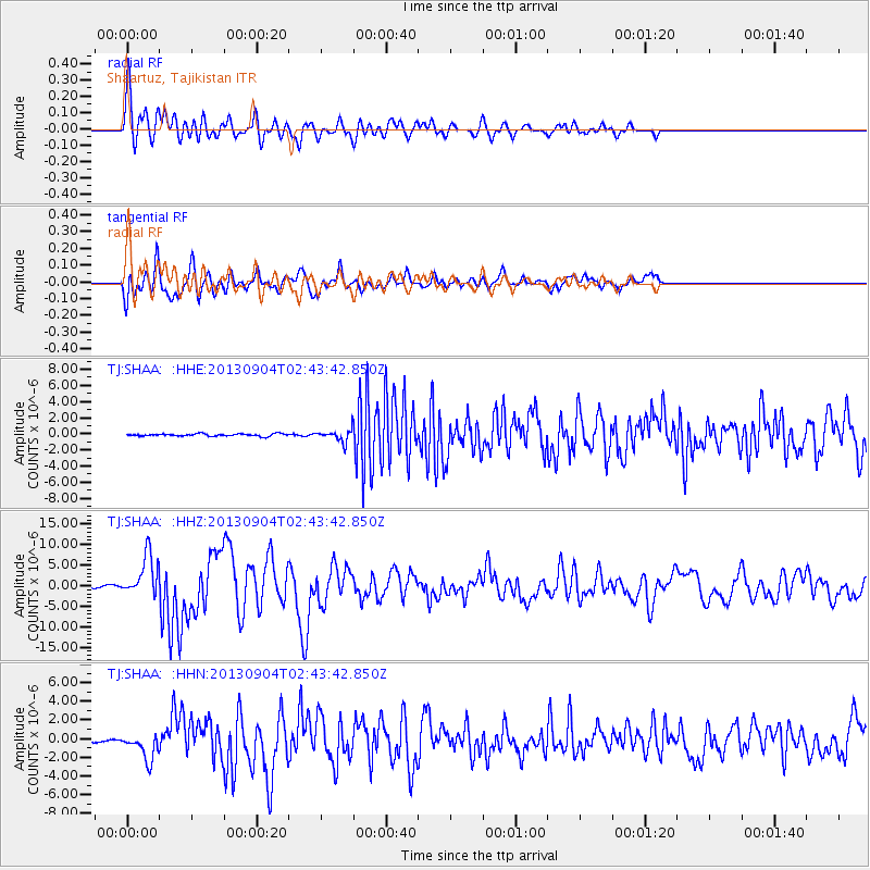
Earthquake location: Andreanof Islands, Aleutian Is.
Earthquake latitude/longitude: 51.6/-174.8
Earthquake time(UTC): 2013/09/04 (247) 02:32:30 GMT
Earthquake Depth: 20 km
Earthquake Magnitude: 6.5 MWW, 5.9 ML, 6.3 MWB, 6.5 MI, 6.5 MWC, 6.5 MWW
Earthquake Catalog/Contributor: NEIC PDE/NEIC COMCAT
Network: TJ Tajikistan National Seismic Network
Station: SHAA Shaartuz, Tajikistan
Lat/Lon: 37.56 N/68.12 E
Elevation: 868 m
Distance: 75.6 deg
Az: 313.097 deg
Baz: 35.005 deg
Ray Param: 0.051518667
Estimated Moho Depth: 35.75 km
Estimated Crust Vp/Vs: 1.84
Assumed Crust Vp: 6.213 km/s
Estimated Crust Vs: 3.372 km/s
Estimated Crust Poisson's Ratio: 0.29
Radial Match: 89.040665 %
Radial Bump: 400
Transverse Match: 80.42688 %
Transverse Bump: 400
SOD ConfigId: 626651
Insert Time: 2014-04-18 10:24:51.356 +0000
GWidth: 2.5
Max Bumps: 400
Tol: 0.001

Signal To Noise

ChannelStoNSTALTA
TJ:SHAA: :HHZ:20130904T02:43:42.850Z28.7477635.035965E-61.7517762E-7
TJ:SHAA: :HHN:20130904T02:43:42.850Z9.38541.4170171E-61.50981E-7
TJ:SHAA: :HHE:20130904T02:43:42.850Z4.90192377.1642114E-71.4615101E-7
Arrivals
Ps5.0 SECOND
PpPs16 SECOND
PsPs/PpSs21 SECOND