
ACSO Alum Creek State Park, Ohio, USA - Earthquake Result Viewer
| ||||||||||||||||||
| ||||||||||||||||||
| ||||||||||||||||||
|
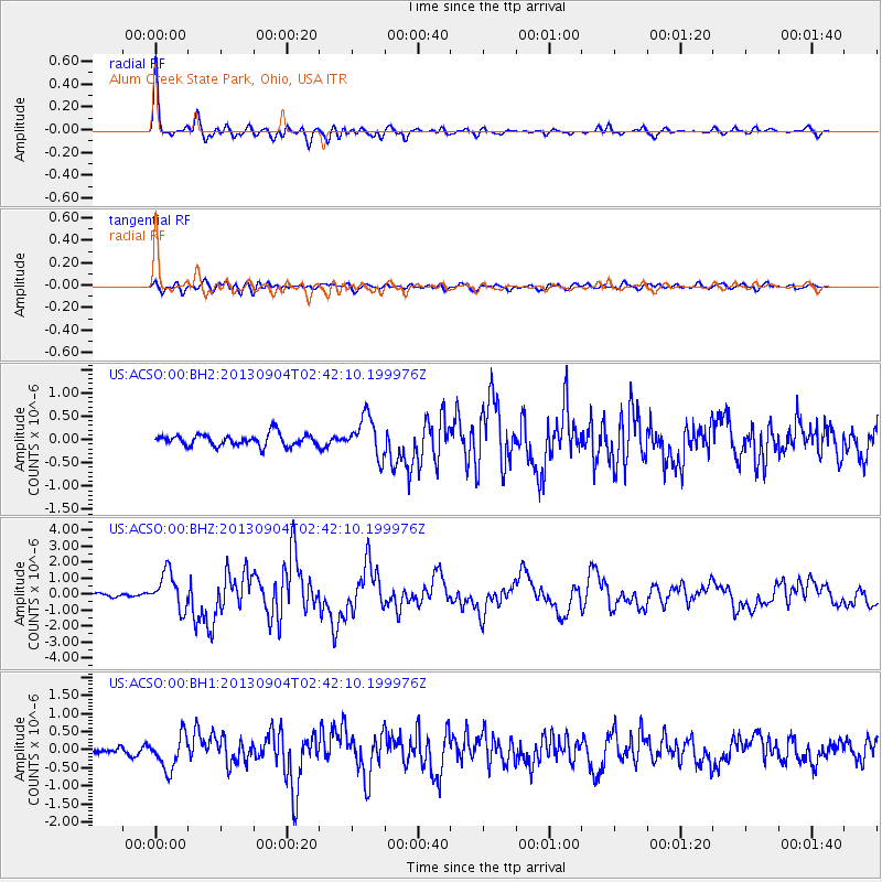
Signal To Noise
| Channel | StoN | STA | LTA |
| US:ACSO:00:BHZ:20130904T02:42:10.199976Z | 10.325399 | 1.1325981E-6 | 1.0969048E-7 |
| US:ACSO:00:BH1:20130904T02:42:10.199976Z | 5.9426675 | 4.6102477E-7 | 7.757876E-8 |
| US:ACSO:00:BH2:20130904T02:42:10.199976Z | 3.3896298 | 4.266066E-7 | 1.258564E-7 |
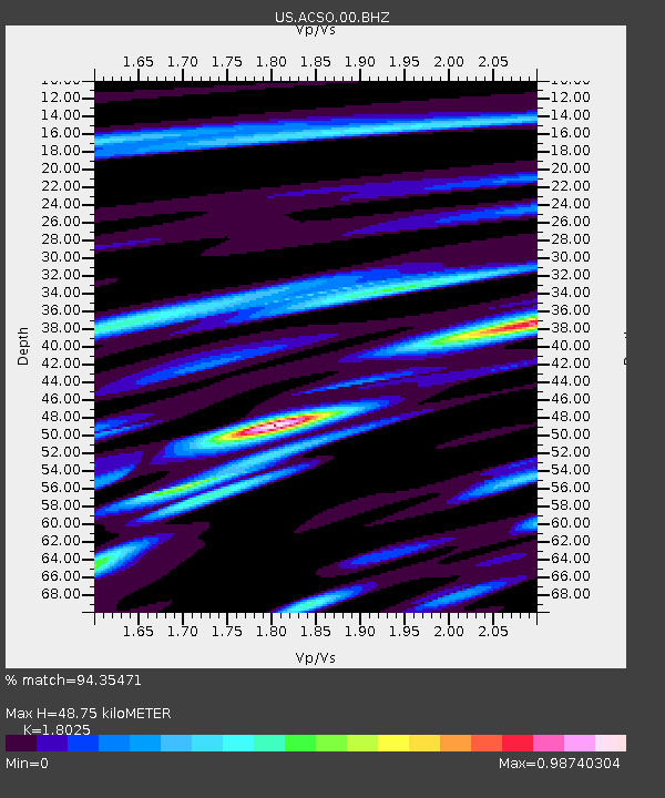
| Arrivals | |
| Ps | 6.3 SECOND |
| PpPs | 20 SECOND |
| PsPs/PpSs | 26 SECOND |

