
AHID Auburn Hatchery, Idaho, USA - Earthquake Result Viewer
| ||||||||||||||||||
| ||||||||||||||||||
| ||||||||||||||||||
|
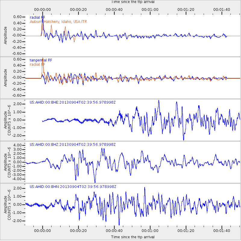
Signal To Noise
| Channel | StoN | STA | LTA |
| US:AHID:00:BHZ:20130904T02:39:56.978998Z | 4.671513 | 5.8397717E-7 | 1.2500814E-7 |
| US:AHID:00:BHN:20130904T02:39:56.978998Z | 1.3575186 | 1.928276E-7 | 1.4204417E-7 |
| US:AHID:00:BHE:20130904T02:39:56.978998Z | 1.183638 | 1.6121251E-7 | 1.3620087E-7 |
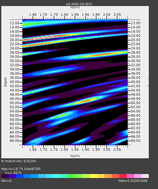
| Arrivals | |
| Ps | 2.2 SECOND |
| PpPs | 7.6 SECOND |
| PsPs/PpSs | 9.8 SECOND |

