You are here: Home > Network List > US - United States National Seismic Network Stations List
> Station AMTX Amarillo, Texas, USA > Earthquake Result Viewer
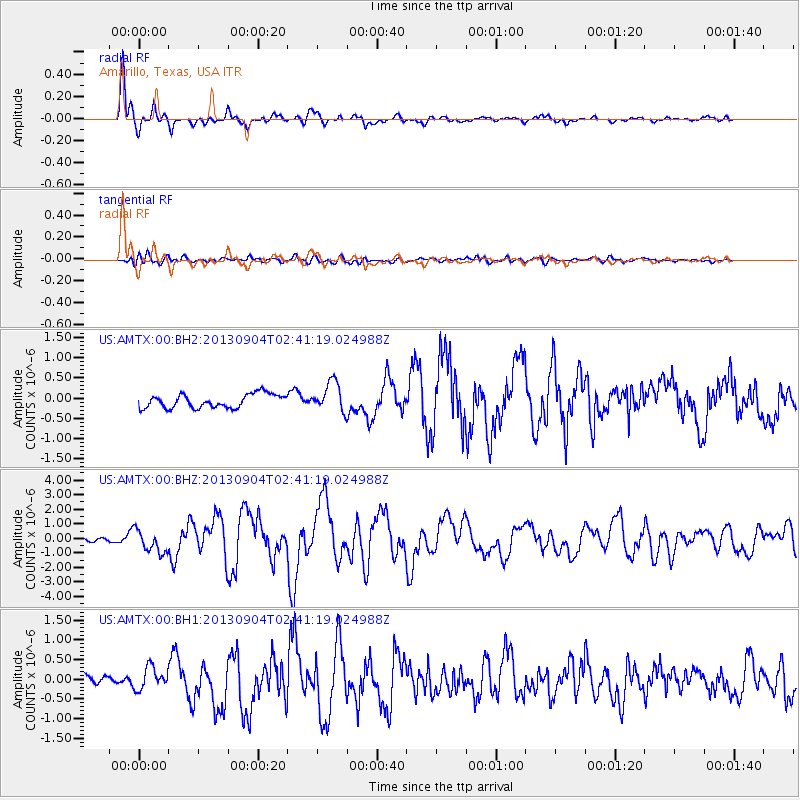
AMTX Amarillo, Texas, USA - Earthquake Result Viewer
*The percent match for this event was below the threshold and hence no stack was calculated.
| Earthquake location: |
Andreanof Islands, Aleutian Is. |
| Earthquake latitude/longitude: |
51.6/-174.8 |
| Earthquake time(UTC): |
2013/09/04 (247) 02:32:30 GMT |
| Earthquake Depth: |
20 km |
| Earthquake Magnitude: |
6.5 MWW, 5.9 ML, 6.3 MWB, 6.5 MI, 6.5 MWC, 6.5 MWW |
| Earthquake Catalog/Contributor: |
NEIC PDE/NEIC COMCAT |
|
| Network: |
US United States National Seismic Network |
| Station: |
AMTX Amarillo, Texas, USA |
| Lat/Lon: |
34.53 N/101.41 W |
| Elevation: |
1010 m |
|
| Distance: |
54.0 deg |
| Az: |
78.04 deg |
| Baz: |
312.29 deg |
| Ray Param: |
$rayparam |
*The percent match for this event was below the threshold and hence was not used in the summary stack. |
|
| Radial Match: |
93.8973 % |
| Radial Bump: |
387 |
| Transverse Match: |
70.65042 % |
| Transverse Bump: |
400 |
| SOD ConfigId: |
626651 |
| Insert Time: |
2014-04-18 10:25:29.478 +0000 |
| GWidth: |
2.5 |
| Max Bumps: |
400 |
| Tol: |
0.001 |
|
Signal To Noise
| Channel | StoN | STA | LTA |
| US:AMTX:00:BHZ:20130904T02:41:19.024988Z | 6.632001 | 7.7514227E-7 | 1.168791E-7 |
| US:AMTX:00:BH1:20130904T02:41:19.024988Z | 2.7036288 | 2.822042E-7 | 1.04379794E-7 |
| US:AMTX:00:BH2:20130904T02:41:19.024988Z | 2.2088094 | 3.9037158E-7 | 1.7673393E-7 |
| Arrivals |
| Ps | |
| PpPs | |
| PsPs/PpSs | |


